Cof Cymru: National Historic Assets of Wales · Wales
Former Counting House
Talybont-on-Usk, Powys, Wales
A Grade II listed building in Talybont on Usk, Powys, designated on 17 December 1998.
The record
- Designation
- Listed building, Grade II
- Broad class
- Industrial
- Date of designation
- 17 December 1998
- Locality
- Talybont on Usk
- Community
- Talybont-on-Usk
- Unitary authority
- Powys
- Country
- Wales
- Coordinates
- 51.89270, -3.28377
- Cadw reference
- 21130
Slide toward Today to fade the historical sheet and see the modern map underneath.
David Rumsey Map Collection, Stanford LibrariesDavid Rumsey Map Collection, Stanford LibrariesDavid Rumsey Map Collection, Stanford LibrariesDavid Rumsey Map Collection, Stanford LibrariesDavid Rumsey Map Collection, Stanford Libraries
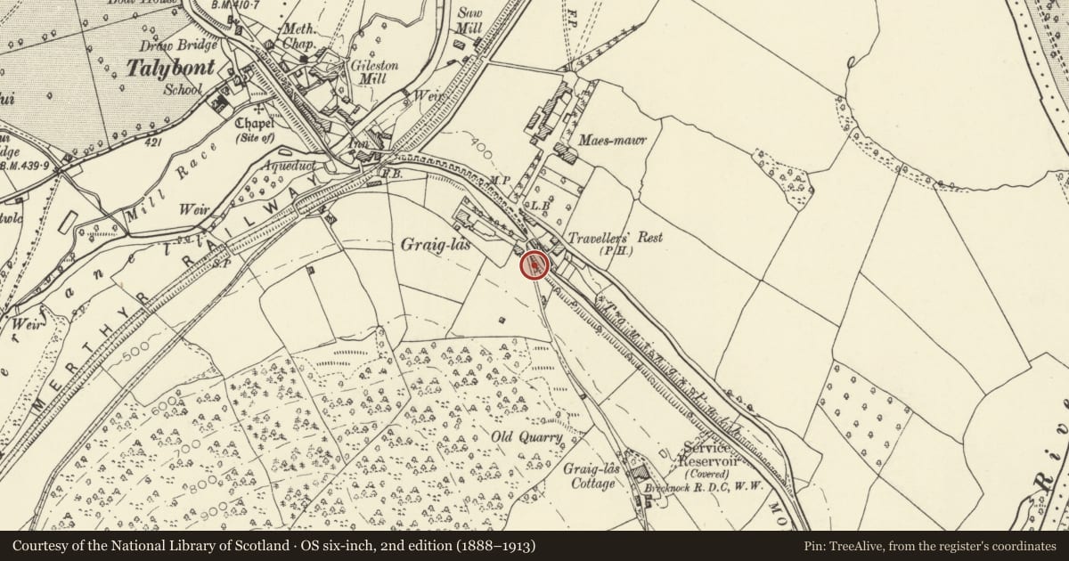
5 historical maps cover this location, the earliest the 1608 map "(13) Cambriae Typus." (David Rumsey Map Collection, Stanford Libraries).
Historical maps covering this location
- 1608 · (13) Cambriae Typus. (David Rumsey Map Collection, Stanford Libraries)
- 1636 · Cornubia : Devonia, Somersetus, Dorcestria, Wiltonia, Glocestria ... (David Rumsey Map Collection, Stanford Libraries)
- 1856 · 42. Brecon. (David Rumsey Map Collection, Stanford Libraries)
- 1896 · 214 Talgarth (Hills) (David Rumsey Map Collection, Stanford Libraries)
- 1901 · Sheet 14. (David Rumsey Map Collection, Stanford Libraries)
Cadw's description
Location
Set into the bank above the canal, one side fronting the mountain road the other the canal, on the SE edge of Talybont village.
History
Built 1814 at the end of the Brynoer tramroad by Jonathan Dixon and owned by Snead, partner of Bromage and Snead, Brecon Bankers. The tramroad terminated here alongside canal. Lower storey fronts the Brecknock and Abergavenny canal. Refurbished and extended as a dwelling; photograph taken beforehand shows core of building much as at present.
Exterior
A small building of toll-house style built into the canal bank. Of stone rubble with Welsh slate roof with decorative bargeboards, large square axial stack. Single storey single room building at roadside, 2 storeys at canal level. Pointed arched window with Gothick glazing in gable end onto road and former doorway, converted to window, with inset stone seat beside; faces up former tramroad. Timber additions to side and rear.
Interior
Converted to dwelling.
Reason for designation
Listed for its special importance in relation to the canal and the tramroad and for special interest as part of a group of buildings associated with the canal and tramroad.
Nearby in the register
- Yr AildyDomesticunder 1 mi
- GlynderiDomesticunder 1 mi
- Limekilns at BrynhyfrydIndustrialunder 1 mi
- BrynhyfrydDomesticunder 1 mi
Other entries of the same register within about three miles of this one, by straight line.