Cof Cymru: National Historic Assets of Wales · Wales
Agricultural Range immediately S of Glasmor
Nantglyn, Denbighshire, Wales
A Grade II listed building in Nantglyn, Denbigh, Denbighshire, designated on 15 December 1998.
The record
- Designation
- Listed building, Grade II
- Broad class
- Agriculture and Subsistence
- Date of designation
- 15 December 1998
- Locality
- Nantglyn
- Town
- Denbigh
- Community
- Nantglyn
- Unitary authority
- Denbighshire
- Country
- Wales
- Coordinates
- 53.14604, -3.48983
- Cadw reference
- 20987
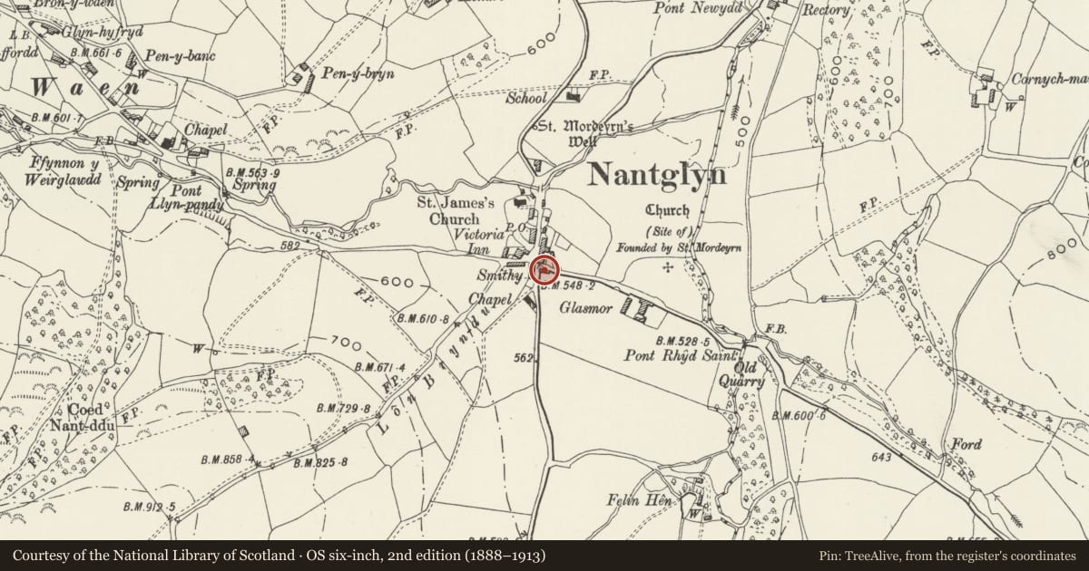
Slide toward Today to fade the historical sheet and see the modern map underneath.
David Rumsey Map Collection, Stanford LibrariesLlyfrgell Genedlaethol Cymru – The National Library of WalesDavid Rumsey Map Collection, Stanford LibrariesDavid Rumsey Map Collection, Stanford LibrariesDavid Rumsey Map Collection, Stanford Libraries
5 historical maps cover this location, the earliest the 1608 map "(13) Cambriae Typus." (David Rumsey Map Collection, Stanford Libraries).
Historical maps covering this location
- 1608 · (13) Cambriae Typus. (David Rumsey Map Collection, Stanford Libraries)
- 1795 · To Sir Watkin Williams-Wynn Bart ... the map of the six counties of North Wales is most… (Llyfrgell Genedlaethol Cymru – The National Library of Wales)
- 1830 · V.3:11-15:XV. Britisches Reich. A. Kon: England. b. Frstenthum Wales: Shire: 37-40 (David Rumsey Map Collection, Stanford Libraries)
- 1883 · Watershed map England, Wales 3. (David Rumsey Map Collection, Stanford Libraries)
- 1901 · Sheet 9 and 10. (David Rumsey Map Collection, Stanford Libraries)
Cadw's description
Location
Prominently located at the crossroads at the southern end of the village, opposite Glasmor.
History
Agricultural range built in 1762 to serve the adjacent farm of Glasmor and unusual in its village setting. The range has a stone date plaque with the incised initials RWM and the date 1762. It originated as a stables with hay-loft over and appears subsequently to have been extended by 2 bays to the L in the C19.
Exterior
Rectangular agricultural range consisting of a primary section to the R and a later (or rebuilt) section adjoining flush to the L. Of rubble construction, the primary part of coursed, rough-dressed local slate-stone; continuous slated roof, recently renewed. The primary section has 2 entrances to the L with pegged wooden frames and boarded doors. That to the L is lower and has an exposed wooden lintel. Above this is an inset slate plaque inscribed with the date 1762 and the initials RMW. Under the eaves are two small 2-light, unglazed windows with wooden frames. At the far R is an upper, wooden- framed entrance, with stone-stepped access. The left-hand section has a segmentally-arched entrance with slate-stone voussoirs and a pegged oak frame; boarded door. A later C19 lean-to adjoins the L gable end, with a low boarded and framed entrance to the road side.
Plain rear with large corrugated iron doors to the lean-to section. The rear wall of the later section was found to have partly collapsed at the time of survey.
Interior
Four-bay interior with original pegged oak raking strut trusses and plain joisted ceiling.
Reason for designation
Listed for its special interest as a dated mid C18 stable range forming part of a village farm group in an unusual village setting.
Group value with Glasmor.
Nearby in the register
- GlasmorDomesticunder 1 mi
- Barn Range to the W of GlasmorAgriculture and Subsistenceunder 1 mi
- Telephone Call-boxCommunicationsunder 1 mi
- Parish Church of St JamesReligious, Ritual and Funeraryunder 1 mi
Other entries of the same register within about three miles of this one, by straight line.