Cof Cymru: National Historic Assets of Wales · Wales
Outbuilding at Church Farm
Wick, Vale of Glamorgan, Wales
A Grade II listed building in Picket, Wick, Vale of Glamorgan, designated on 27 November 1998.
The record
- Designation
- Listed building, Grade II
- Broad class
- Agriculture and Subsistence
- Date of designation
- 27 November 1998
- Locality
- Picket
- Community
- Wick
- Unitary authority
- Vale of Glamorgan
- Country
- Wales
- Coordinates
- 51.44785, -3.54062
- Cadw reference
- 20981
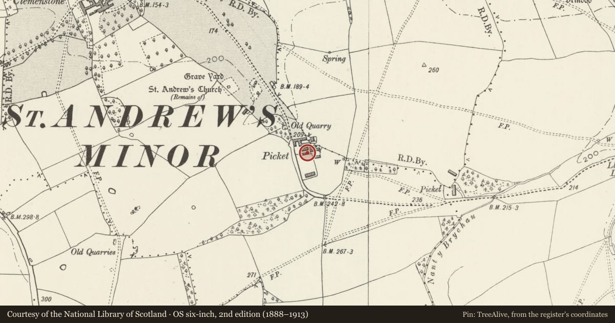
Slide toward Today to fade the historical sheet and see the modern map underneath.
David Rumsey Map Collection, Stanford LibrariesDavid Rumsey Map Collection, Stanford LibrariesDavid Rumsey Map Collection, Stanford LibrariesDavid Rumsey Map Collection, Stanford LibrariesDavid Rumsey Map Collection, Stanford Libraries
5 historical maps cover this location, the earliest the 1636 map "Cornubia : Devonia, Somersetus, Dorcestria, Wiltonia, Glocestria ..." (David Rumsey Map Collection, Stanford Libraries).
Historical maps covering this location
- 1636 · Cornubia : Devonia, Somersetus, Dorcestria, Wiltonia, Glocestria ... (David Rumsey Map Collection, Stanford Libraries)
- 1637 · The fourth table of England. Cornub. Devonia, Somerset etc. (David Rumsey Map Collection, Stanford Libraries)
- 1865 · England and Wales. England No. 6. (David Rumsey Map Collection, Stanford Libraries)
- 1897 · 262 Pontypridd (Hills) (David Rumsey Map Collection, Stanford Libraries)
- 1897 · 262 Pontypridd (Outline) (David Rumsey Map Collection, Stanford Libraries)
Cadw's description
Location
Picket is a hamlet on the NE boundary of Wick Community. The farm buildings are to the S of Church farm. This building is the SW of a group of 4 to S of Mill Threshing Barn and Cartshed.
Exterior
Long single storey range in rubble stone with hipped slate roof.
Reason for designation
Included as part of an interesting group of Victorian Model farm buildings. Group value with Mill Threshing Barn and Cartshed, to N.
Nearby in the register
- Outbuilding at Church FarmAgriculture and Subsistenceunder 1 mi
- Outbuiding at Church FarmAgriculture and Subsistenceunder 1 mi
- Outbuilding at Church farmAgriculture and Subsistenceunder 1 mi
- Mill, Threshing Barn and Cart Shed at Church FarmAgriculture and Subsistenceunder 1 mi
Other entries of the same register within about three miles of this one, by straight line.