Cof Cymru: National Historic Assets of Wales · Wales
Trepit Cottage
Wick, Vale of Glamorgan, Wales
A Grade II listed building in Trepit, Wick, Vale of Glamorgan, designated on 27 November 1998.
The record
- Designation
- Listed building, Grade II
- Broad class
- Domestic
- Date of designation
- 27 November 1998
- Locality
- Trepit
- Community
- Wick
- Unitary authority
- Vale of Glamorgan
- Country
- Wales
- Coordinates
- 51.43781, -3.55875
- Cadw reference
- 20973
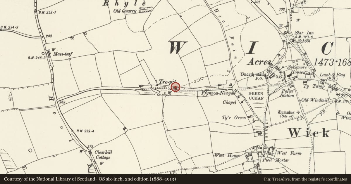
Slide toward Today to fade the historical sheet and see the modern map underneath.
David Rumsey Map Collection, Stanford LibrariesDavid Rumsey Map Collection, Stanford LibrariesDavid Rumsey Map Collection, Stanford LibrariesDavid Rumsey Map Collection, Stanford LibrariesDavid Rumsey Map Collection, Stanford Libraries
5 historical maps cover this location, the earliest the 1636 map "Cornubia : Devonia, Somersetus, Dorcestria, Wiltonia, Glocestria ..." (David Rumsey Map Collection, Stanford Libraries).
Historical maps covering this location
- 1636 · Cornubia : Devonia, Somersetus, Dorcestria, Wiltonia, Glocestria ... (David Rumsey Map Collection, Stanford Libraries)
- 1637 · The fourth table of England. Cornub. Devonia, Somerset etc. (David Rumsey Map Collection, Stanford Libraries)
- 1865 · England and Wales. England No. 6. (David Rumsey Map Collection, Stanford Libraries)
- 1897 · 262 Pontypridd (Hills) (David Rumsey Map Collection, Stanford Libraries)
- 1897 · 262 Pontypridd (Outline) (David Rumsey Map Collection, Stanford Libraries)
Cadw's description
Location
Located in the hamlet of Trepit to the W of Wick, and on the N side of the lane.
History
Probably mid C19. ot shown on the tithe map of 1840
Exterior
Small 2-window, 2-storey cottage. Rough cast over masonry, slate roof with rendered end stacks. Symmetrical front with central entrance. Planked door in small porch with stone lintel. Small 2-light casement windows with architraves and stone sills, those to the upper storey rising to the eaves. Adjoining single storey range to W; rubble masonry with corrugated iron roof.
Interior
No access to interior at time of inspection (11/12/97).
Reason for designation
Listed as a rare unaltered example of a small vernacular dwelling of regional type.
Nearby in the register
- Buarth-Mawr BarnBarnunder 1 mi
- Rhyle Round BarrowRound Barrowunder 1 mi
- Remains of Preaching Cross, Church of St. JamesReligious, Ritual and Funeraryunder 1 mi
- Church of St. JamesReligious, Ritual and Funeraryunder 1 mi
Other entries of the same register within about three miles of this one, by straight line.