Cof Cymru: National Historic Assets of Wales · Wales
Tyn Rhos Uchaf
Aberffraw, Isle of Anglesey, Wales
A Grade II listed building in Soar, Aberffraw, Isle of Anglesey, designated on 25 November 1998.
The record
- Designation
- Listed building, Grade II
- Broad class
- Domestic
- Date of designation
- 25 November 1998
- Locality
- Soar
- Community
- Aberffraw
- Unitary authority
- Isle of Anglesey
- Country
- Wales
- Coordinates
- 53.21895, -4.42705
- Cadw reference
- 20963
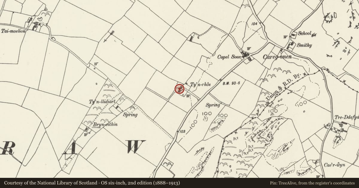
Slide toward Today to fade the historical sheet and see the modern map underneath.
David Rumsey Map Collection, Stanford LibrariesDavid Rumsey Map Collection, Stanford LibrariesDavid Rumsey Map Collection, Stanford LibrariesDavid Rumsey Map Collection, Stanford LibrariesDavid Rumsey Map Collection, Stanford Libraries
5 historical maps cover this location, the earliest the 1883 map "Watershed map England, Wales 3." (David Rumsey Map Collection, Stanford Libraries).
Historical maps covering this location
- 1883 · Watershed map England, Wales 3. (David Rumsey Map Collection, Stanford Libraries)
- 1896 · Sheet 7. Ordnance Survey of England and Wales. (David Rumsey Map Collection, Stanford Libraries)
- 1899 · 105 Carnarvon (Hills) (David Rumsey Map Collection, Stanford Libraries)
- 1901 · Sheet 9 and 10. (David Rumsey Map Collection, Stanford Libraries)
- 1919 · Sheet 41. Anglesey. (David Rumsey Map Collection, Stanford Libraries)
Cadw's description
Location
Set back from the NW side of a country road c. 500m SW of Soar and c. 4km NE of Aberffraw.
History
Early C19 vernacular farmhouse. A datestone over the doorway is inscribed: 1824 P E.
Exterior
A 2-storey, 2-unit plan farmhouse with shorter service range (dairy/kitchen) to left (SW). Built of rubble masonry, the right (NE) gable return rendered. Roof of small slates with rendered copings and gable stacks; massive stack to service range. Principal elevation a 2-window range with doorway between, openings offset to right (NE); windows are slightly recessed, 4-pane horned sashes with slate sills, doorway is square-headed with a datestone above reading: 1824 P E. Service range to left (SW) with similarly detailed ground floor window, the first floor opening now blocked. The rear elevation has scattered fenestration of varyingly sized 4-pane sash windows, including a central stair window, and a square-headed doorway to the NE end.
Reason for designation
Listed as a good example of an early C19 farmhouse of a characteristic regional type; retaining its simple vernacular character, including the use of small roofing slates, and sash windows.
Nearby in the register
- Treddafydd IsafDomesticunder 1 mi
- Agricultural range at Tre-Ddafydd-uchaf also known as Tre-Ddafydd-fawrAgriculture and Subsistenceunder 1 mi
- Stables to NW of Tre-Ddafydd-uchaf also known as Treddafydd-fawrDomesticunder 1 mi
- Tre-Ddafydd-uchaf also known as Treddafydd-fawrDomesticunder 1 mi
Other entries of the same register within about three miles of this one, by straight line.