Cof Cymru: National Historic Assets of Wales · Wales
Colwyn Cottage
Beddgelert, Gwynedd, Wales
A Grade II listed building in Beddgelert, Porthmadog, Gwynedd, designated on 25 November 1998.
The record
- Designation
- Listed building, Grade II
- Broad class
- Domestic
- Date of designation
- 25 November 1998
- Locality
- Beddgelert
- Town
- Porthmadog
- Community
- Beddgelert
- Unitary authority
- Gwynedd
- Country
- Wales
- Coordinates
- 53.01208, -4.10114
- Cadw reference
- 20953
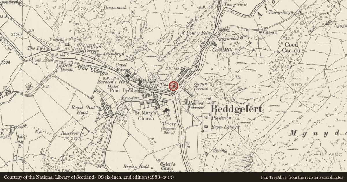
Slide toward Today to fade the historical sheet and see the modern map underneath.
David Rumsey Map Collection, Stanford LibrariesDavid Rumsey Map Collection, Stanford LibrariesDavid Rumsey Map Collection, Stanford LibrariesLlyfrgell Genedlaethol Cymru – The National Library of WalesDavid Rumsey Map Collection, Stanford Libraries
5 historical maps cover this location, the earliest the 1795 map "To Sir Watkin Williams-Wynn Bart ... the map of the six counties of North Wales is most humbly inscribed by his obedient humble servant" (Llyfrgell Genedlaethol Cymru – The National Library of Wales).
Historical maps covering this location
- 1795 · To Sir Watkin Williams-Wynn Bart ... the map of the six counties of North Wales is most… (Llyfrgell Genedlaethol Cymru – The National Library of Wales)
- 1883 · Watershed map England, Wales 3. (David Rumsey Map Collection, Stanford Libraries)
- 1896 · Sheet 7. Ordnance Survey of England and Wales. (David Rumsey Map Collection, Stanford Libraries)
- 1899 · 119 Snowdon (Hills) (David Rumsey Map Collection, Stanford Libraries)
- 1901 · Sheet 9 and 10. (David Rumsey Map Collection, Stanford Libraries)
Cadw's description
Location
On the roadside, to the R of a long boarded garage block.
History
Built in 1852 as the manse for the adjacent Ambrose Congregational Chapel (presently a snooker club) and subsequently the premises of a shoemaker.
Exterior
Small rubble-built gabled manse, built gable-on to the street; of 2 storeys with slate roof and plain bargeboards. Entrance to R with modern boarded door; to the L is a 12-pane C19 replacement sash with projecting slate sill. The upper floor has a smaller, similar window.
Interior
The interior was not inspected at the time of survey.
Reason for designation
Listed for its special interest as a small mid-C19 manse retaining its original external character.
Group value with other listed items on Smith Street.
Nearby in the register
- AbercolwynDomesticunder 1 mi
- PensarnDomesticunder 1 mi
- EncilDomesticunder 1 mi
- Ail OrauDomesticunder 1 mi
Other entries of the same register within about three miles of this one, by straight line.