Cof Cymru: National Historic Assets of Wales · Wales
Bridge House (aka Ty Bont)
Beddgelert, Gwynedd, Wales
A Grade II listed building in Pont Aberglaslyn, Porthmadog, Beddgelert, Gwynedd, designated on 25 November 1998.
The record
- Designation
- Listed building, Grade II
- Broad class
- Domestic
- Date of designation
- 25 November 1998
- Locality
- Pont Aberglaslyn
- Town
- Porthmadog
- Community
- Beddgelert
- Unitary authority
- Gwynedd
- Country
- Wales
- Coordinates
- 52.99500, -4.09617
- Cadw reference
- 20940
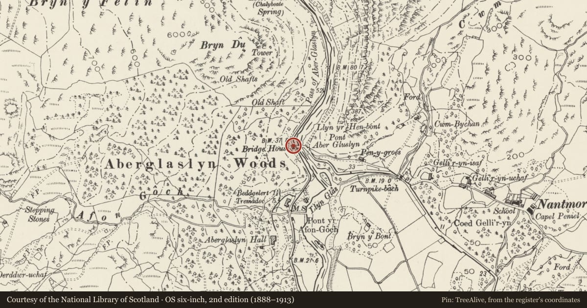
Slide toward Today to fade the historical sheet and see the modern map underneath.
David Rumsey Map Collection, Stanford LibrariesDavid Rumsey Map Collection, Stanford LibrariesDavid Rumsey Map Collection, Stanford LibrariesLlyfrgell Genedlaethol Cymru – The National Library of WalesDavid Rumsey Map Collection, Stanford Libraries
5 historical maps cover this location, the earliest the 1795 map "To Sir Watkin Williams-Wynn Bart ... the map of the six counties of North Wales is most humbly inscribed by his obedient humble servant" (Llyfrgell Genedlaethol Cymru – The National Library of Wales).
Historical maps covering this location
- 1795 · To Sir Watkin Williams-Wynn Bart ... the map of the six counties of North Wales is most… (Llyfrgell Genedlaethol Cymru – The National Library of Wales)
- 1883 · Watershed map England, Wales 3. (David Rumsey Map Collection, Stanford Libraries)
- 1896 · Sheet 7. Ordnance Survey of England and Wales. (David Rumsey Map Collection, Stanford Libraries)
- 1899 · 119 Snowdon (Hills) (David Rumsey Map Collection, Stanford Libraries)
- 1901 · Sheet 9 and 10. (David Rumsey Map Collection, Stanford Libraries)
Cadw's description
Location
Located directly opposite the Pont Aberglaslyn, on the road side.
History
Mid C19 house, built for the Aberglaslyn estate in the characteristic Tudorbethan vernacular style commonly employed for such contemporary estate buildings.
Exterior
Lodge-scale house with later additions. Two-storey, 3-bay, with lower one-bay wing set back to the R. Of randomly-coursed, roughly-squared stone blocks under a modern slate roof with deep verges and eaves; plain modern bargeboards and simple end chimneys. Central entrance with boarded door. Above this is a first-floor projecting bay carried on shaped corbels and with hipped roof; rectangular projecting oriel, again corbelled, and with plain glazing. Flanking the entrance on the ground floor are similar corbelled bays with hipped slate roofs; above these are first-floor dormer windows with hipped roofs. A plain stringcourse projects between the ground and first floors. The lower wing to the R has an end chimney and a modern window to the front, contained within a primary opening.
A C20 corrugated iron addition adjoins to the L.
Interior
The interior was not inspected at the time of survey.
Reason for designation
Listed as a mid C19 estate house of distinctive rustic design in a prominent road-side location.
Group value with Pont Aberglaslyn.
Nearby in the register
- Pont AberglaslynTransportunder 1 mi
- Pen-y-GroesDomesticunder 1 mi
- Bron-yr-AurDomesticunder 1 mi
- Hut circle settlement above Afon GochHut Circle Settlementunder 1 mi
Other entries of the same register within about three miles of this one, by straight line.