Cof Cymru: National Historic Assets of Wales · Wales
Byre at Penygilfach
The Vale of Grwyney, Powys, Wales
A Grade II listed building in Penygilfach, The Vale of Grwyney, Powys, designated on 19 November 1998.
The record
- Designation
- Listed building, Grade II
- Broad class
- Agriculture and Subsistence
- Date of designation
- 19 November 1998
- Locality
- Penygilfach
- Community
- The Vale of Grwyney
- Unitary authority
- Powys
- Country
- Wales
- Coordinates
- 51.86468, -3.09596
- Cadw reference
- 20891
Slide toward Today to fade the historical sheet and see the modern map underneath.
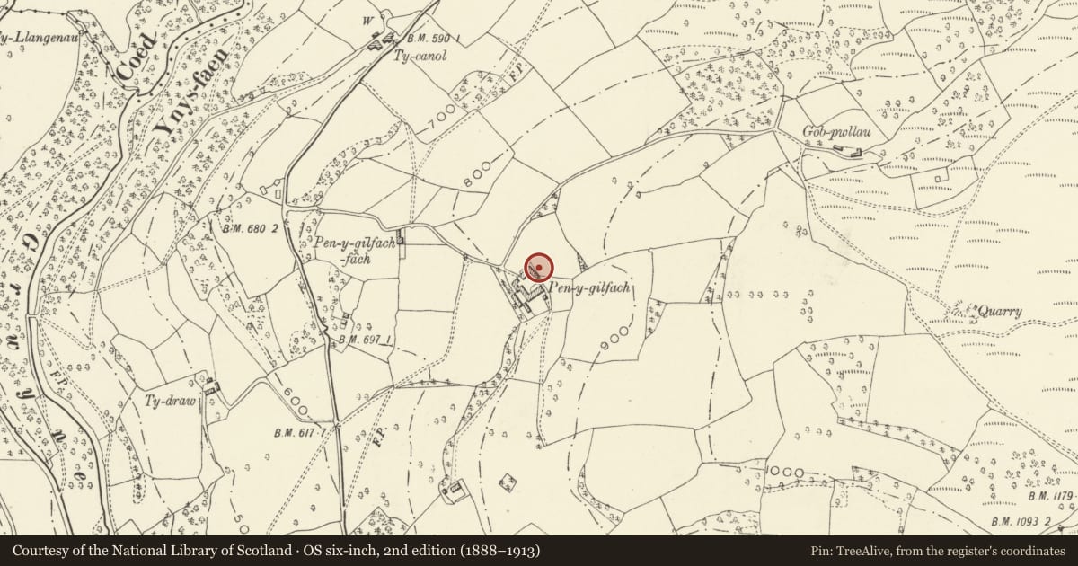
David Rumsey Map Collection, Stanford LibrariesDavid Rumsey Map Collection, Stanford LibrariesDavid Rumsey Map Collection, Stanford LibrariesDavid Rumsey Map Collection, Stanford LibrariesDavid Rumsey Map Collection, Stanford Libraries
5 historical maps cover this location, the earliest the 1636 map "Cornubia : Devonia, Somersetus, Dorcestria, Wiltonia, Glocestria ..." (David Rumsey Map Collection, Stanford Libraries).
Historical maps covering this location
- 1636 · Cornubia : Devonia, Somersetus, Dorcestria, Wiltonia, Glocestria ... (David Rumsey Map Collection, Stanford Libraries)
- 1856 · 42. Brecon. (David Rumsey Map Collection, Stanford Libraries)
- 1898 · 232 Abergavenny (Hills) (David Rumsey Map Collection, Stanford Libraries)
- 1898 · 232 Abergavenny (Outline) (David Rumsey Map Collection, Stanford Libraries)
- 1901 · Sheet 14. (David Rumsey Map Collection, Stanford Libraries)
Cadw's description
Location
On NE side and facing the farm yard.
History
Erected 1870s after Andrew Doyle had purchased the Pendarren Estate, to which Penygilfach belonged. New buildings erected at Penygilfach included stables, cart shed and cow houses, in addition to earlier buildings at the farm, some of which were improved. The new buildings were in a characteristic estate style of snecked masonry and tile roofs. Penygilfach is said to have been occupied by the manager of the farms on the Pendarren Estate.
Exterior
Of snecked sandstone with bigger quoins, and tile roof. To the yard are 3 wide segmental-headed doorways with rebates and boarded doors. Above are 2 equally-placed dormers with 4-pane windows pivoting centrally. The L gable end has a boarded door to L under a segmental head. Set back to R is a lower projection with 2 boarded doors and adjacent windows.
Interior
Not inspected at time of survey (December 1997).
Reason for designation
Included for group value with Penygilfach farmhouse.
Nearby in the register
- PenygilfachDomesticunder 1 mi
- Bakehouse and Cider Cellar at PenygilfachDomesticunder 1 mi
- Ty CanolDomesticunder 1 mi
- Packhorse BridgeTransportunder 1 mi
Other entries of the same register within about three miles of this one, by straight line.