Cof Cymru: National Historic Assets of Wales · Wales
Barn with attached L-shaped range at Penlan
The Vale of Grwyney, Powys, Wales
A Grade II listed building in Penlan, The Vale of Grwyney, Powys, designated on 19 November 1998.
The record
- Designation
- Listed building, Grade II
- Broad class
- Agriculture and Subsistence
- Date of designation
- 19 November 1998
- Locality
- Penlan
- Community
- The Vale of Grwyney
- Unitary authority
- Powys
- Country
- Wales
- Coordinates
- 51.87223, -3.08851
- Cadw reference
- 20889
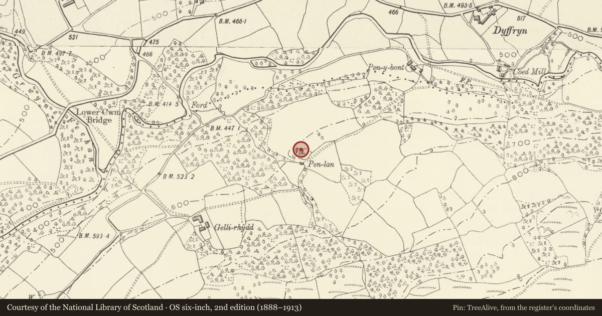
Slide toward Today to fade the historical sheet and see the modern map underneath.
David Rumsey Map Collection, Stanford LibrariesDavid Rumsey Map Collection, Stanford LibrariesDavid Rumsey Map Collection, Stanford LibrariesDavid Rumsey Map Collection, Stanford LibrariesDavid Rumsey Map Collection, Stanford Libraries
5 historical maps cover this location, the earliest the 1636 map "Cornubia : Devonia, Somersetus, Dorcestria, Wiltonia, Glocestria ..." (David Rumsey Map Collection, Stanford Libraries).
Historical maps covering this location
- 1636 · Cornubia : Devonia, Somersetus, Dorcestria, Wiltonia, Glocestria ... (David Rumsey Map Collection, Stanford Libraries)
- 1856 · 42. Brecon. (David Rumsey Map Collection, Stanford Libraries)
- 1895 · Sheet 11. Ordnance Survey of England and Wales. (David Rumsey Map Collection, Stanford Libraries)
- 1898 · 232 Abergavenny (Hills) (David Rumsey Map Collection, Stanford Libraries)
- 1901 · Sheet 14. (David Rumsey Map Collection, Stanford Libraries)
Cadw's description
Location
On W side of house, which is situated approximately 1.3km SE of Llanbedr church.
History
Probably C18 barn, with the roof renewed C19.
Exterior
Barn of rubble sandstone and restored stone tile roof. Renewed double full-height boarded doors to cart passage R of centre are flanked by ventilation slits. To the L is a renewed boarded door under a timber lintel. Loft opening in L gable end. The rear cart passage doorway has inserted glazing and boarding below, and is flanked by ventilation slits. Further R is a small opening. The R gable end has a lean-to with slate roof attached to cart shed. The cart shed forms one arm of a lately restored L-shaped range, the other arm consisting of farm buildings lately converted to a dwelling. Consisting of rubble stone walls and restored stone tile roof.
Interior
The barn has a 6-bay roof of king posts with raking struts. The cart shed has a similar roof.
Reason for designation
Included for group value with Penlan house.
Nearby in the register
- PenlanDomesticunder 1 mi
- DyffrynDomesticunder 1 mi
- GudderDomesticunder 1 mi
- Ty CanolDomesticunder 1 mi
Other entries of the same register within about three miles of this one, by straight line.