Cof Cymru: National Historic Assets of Wales · Wales
Cart Shed and Cider Mill at Tynyllwyn
The Vale of Grwyney, Powys, Wales
A Grade II listed building in Partrishow, The Vale of Grwyney, Powys, designated on 19 November 1998.
The record
- Designation
- Listed building, Grade II
- Broad class
- Agriculture and Subsistence
- Date of designation
- 19 November 1998
- Locality
- Partrishow
- Community
- The Vale of Grwyney
- Unitary authority
- Powys
- Country
- Wales
- Coordinates
- 51.89495, -3.04763
- Cadw reference
- 20885
Slide toward Today to fade the historical sheet and see the modern map underneath.
David Rumsey Map Collection, Stanford LibrariesDavid Rumsey Map Collection, Stanford LibrariesDavid Rumsey Map Collection, Stanford LibrariesDavid Rumsey Map Collection, Stanford LibrariesDavid Rumsey Map Collection, Stanford Libraries
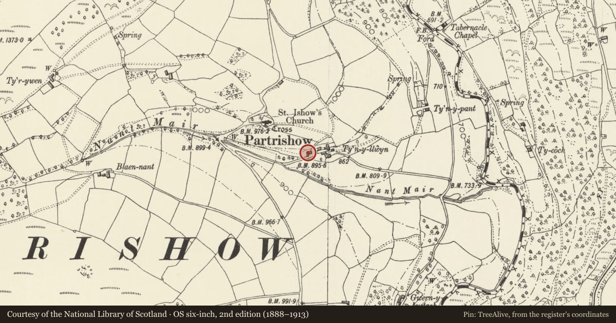
5 historical maps cover this location, the earliest the 1636 map "Cornubia : Devonia, Somersetus, Dorcestria, Wiltonia, Glocestria ..." (David Rumsey Map Collection, Stanford Libraries).
Historical maps covering this location
- 1636 · Cornubia : Devonia, Somersetus, Dorcestria, Wiltonia, Glocestria ... (David Rumsey Map Collection, Stanford Libraries)
- 1856 · 42. Brecon. (David Rumsey Map Collection, Stanford Libraries)
- 1895 · Sheet 11. Ordnance Survey of England and Wales. (David Rumsey Map Collection, Stanford Libraries)
- 1896 · 214 Talgarth (Hills) (David Rumsey Map Collection, Stanford Libraries)
- 1901 · Sheet 14. (David Rumsey Map Collection, Stanford Libraries)
Cadw's description
Location
On W side of house and facing the farm yard, mostly within a field below Partrishow church.
History
Probably C18, with the cider press contained within a later addition.
Exterior
Of rubble stone with a stone tile roof, and comprising the cart shed with a narrower cider mill behind it, and a attached ruined lean-to behind to L. The cart shed has an open-fronted gable end to the yard. In the L side wall is a big splayed buttress, to L of which is a blocked doorway to the cider house and a ventilation slit further L, and with added lean-to at L end. In the R side wall is a ruined former opening to cider mill, whose wall is later and set back behind the wall of the cart shed.
Interior
The cart shed has a tie-beam roof. The R side wall has a raking buttress spanning its entire length housing small beeboles. In the cider house a ruined cider press survives in situ.
Reason for designation
Included for group value as an important component within this exceptional C16/C17 farm group.
Nearby in the register
- Stable at TynyllwynAgriculture and Subsistenceunder 1 mi
- Hen house and attached wall at TynyllwynAgriculture and Subsistenceunder 1 mi
- Barn at TynyllwynAgriculture and Subsistenceunder 1 mi
- Cattle ramp, cobbled pavement and revetment at TynyllwynAgriculture and Subsistenceunder 1 mi
Other entries of the same register within about three miles of this one, by straight line.