Cof Cymru: National Historic Assets of Wales · Wales
Lower Revetment including Steps and Bull Cot at Tynyllwyn
The Vale of Grwyney, Powys, Wales
A Grade II listed building in Partrishow, The Vale of Grwyney, Powys, designated on 19 November 1998.
The record
- Designation
- Listed building, Grade II
- Broad class
- Agriculture and Subsistence
- Date of designation
- 19 November 1998
- Locality
- Partrishow
- Community
- The Vale of Grwyney
- Unitary authority
- Powys
- Country
- Wales
- Coordinates
- 51.89507, -3.04656
- Cadw reference
- 20882
Slide toward Today to fade the historical sheet and see the modern map underneath.
David Rumsey Map Collection, Stanford LibrariesDavid Rumsey Map Collection, Stanford LibrariesDavid Rumsey Map Collection, Stanford LibrariesDavid Rumsey Map Collection, Stanford LibrariesDavid Rumsey Map Collection, Stanford Libraries
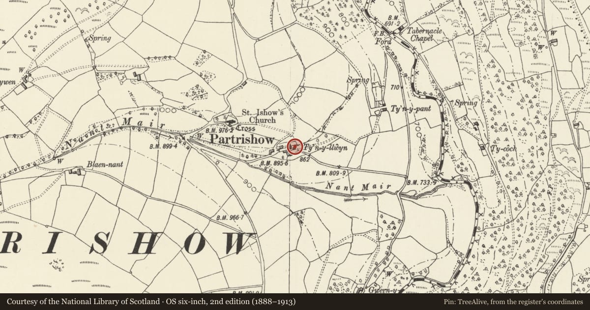
5 historical maps cover this location, the earliest the 1636 map "Cornubia : Devonia, Somersetus, Dorcestria, Wiltonia, Glocestria ..." (David Rumsey Map Collection, Stanford Libraries).
Historical maps covering this location
- 1636 · Cornubia : Devonia, Somersetus, Dorcestria, Wiltonia, Glocestria ... (David Rumsey Map Collection, Stanford Libraries)
- 1856 · 42. Brecon. (David Rumsey Map Collection, Stanford Libraries)
- 1895 · Sheet 11. Ordnance Survey of England and Wales. (David Rumsey Map Collection, Stanford Libraries)
- 1896 · 214 Talgarth (Hills) (David Rumsey Map Collection, Stanford Libraries)
- 1901 · Sheet 14. (David Rumsey Map Collection, Stanford Libraries)
Cadw's description
Location
On S side of house facing the yard and at lower end of the terrace.
History
The revetment is late C16, contemporary with the house. The house, originally a long house with attached byre, was gentrified when the byre was converted to a kitchen in 1649, and when a terraced garden was created on the E side of the house. The steps were probably part of this latter development. The bull cot shows mid C19 repairs.
Exterior
Consisting of a battered rubble-stone revetment which curves around below the house, which has stone steps at the L end, a large rectangular recessed bay containing the bull cot to R, to R of which are the mid C17 stone steps. The bull cot is a lean-to with a stone tile roof. The roof is carried on 2 timber posts R and L of centre, which have stone infill between below boarded openings. To R and L are full-height boarded doors (damaged to L) and stone walls at the ends, rebuilt C19 on R side with hammer-dressed quoins.
Reason for designation
Included for group value as an important component within this exceptional C16/C17 farm group.
Nearby in the register
- Pig Sty, Ty Bach and Associated Walls at TynyllwynAgriculture and Subsistenceunder 1 mi
- Upper Revetment, Goose Cot and Stairs at TynyllwynAgriculture and Subsistenceunder 1 mi
- TynyllwynDomesticunder 1 mi
- Cattle ramp, cobbled pavement and revetment at TynyllwynAgriculture and Subsistenceunder 1 mi
Other entries of the same register within about three miles of this one, by straight line.