Cof Cymru: National Historic Assets of Wales · Wales
Penmoel Cottage
The Vale of Grwyney, Powys, Wales
A Grade II listed building in Llangenny, The Vale of Grwyney, Powys, designated on 19 November 1998.
The record
- Designation
- Listed building, Grade II
- Broad class
- Domestic
- Date of designation
- 19 November 1998
- Locality
- Llangenny
- Community
- The Vale of Grwyney
- Unitary authority
- Powys
- Country
- Wales
- Coordinates
- 51.85271, -3.10921
- Cadw reference
- 20832
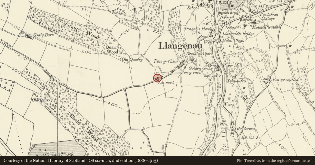
Slide toward Today to fade the historical sheet and see the modern map underneath.
David Rumsey Map Collection, Stanford LibrariesDavid Rumsey Map Collection, Stanford LibrariesDavid Rumsey Map Collection, Stanford LibrariesDavid Rumsey Map Collection, Stanford LibrariesDavid Rumsey Map Collection, Stanford Libraries
5 historical maps cover this location, the earliest the 1636 map "Cornubia : Devonia, Somersetus, Dorcestria, Wiltonia, Glocestria ..." (David Rumsey Map Collection, Stanford Libraries).
Historical maps covering this location
- 1636 · Cornubia : Devonia, Somersetus, Dorcestria, Wiltonia, Glocestria ... (David Rumsey Map Collection, Stanford Libraries)
- 1856 · 42. Brecon. (David Rumsey Map Collection, Stanford Libraries)
- 1898 · 232 Abergavenny (Hills) (David Rumsey Map Collection, Stanford Libraries)
- 1898 · 232 Abergavenny (Outline) (David Rumsey Map Collection, Stanford Libraries)
- 1901 · Sheet 14. (David Rumsey Map Collection, Stanford Libraries)
Cadw's description
Location
Approximately 0.5km SSW of Llangenny church on N side of a minor road between Llangenny and Crickhowell.
History
Mid-late C19 cottage probably built for the Cwrt-y-Gollen Estate.
Exterior
Tudor Gothic style cottage of one-and-a-half storeys, consisting of a main range with a wing set back to R, and a lower added wing to L. Of coursed rubble sandstone and stone tile roof. A stone stack to the wing on R has 3 detached diagonal shafts. The main range is 2-window, with diamond-pattern, iron-frame glazing. To L it has a 3-light mullioned window under hood mould. An advanced cross gable set back from the angle to R has a pendant finial and a 2-light attic casement under a Tudor head. The doorway beneath has a similar head and a boarded door with ornate strap hinges. The wing to R has a 3-light window with hood mould. Its R side wall has a gablet to L with pierced barge boards and pendant finial. A 2-light mullioned window has Y-tracery. The added wing to L has details similar to but plainer than the main range.
Interior
Not inspected at time of survey (December 1997).
Reason for designation
C19 estate cottage retaining distinctive original character and detail.
Nearby in the register
- Druid's AltarDomesticunder 1 mi
- Standing Stone N of Golden GroveStanding Stoneunder 1 mi
- Golden GroveDomesticunder 1 mi
- Drying House of former Golden Grove Paper MillCommercialunder 1 mi
Other entries of the same register within about three miles of this one, by straight line.