Cof Cymru: National Historic Assets of Wales · Wales
Cwmsawdde
Llanddeusant, Carmarthenshire, Wales
A Grade II listed building in Llanddeusant, Llangadog, Carmarthenshire, designated on 10 November 1998.
The record
- Designation
- Listed building, Grade II
- Broad class
- Domestic
- Date of designation
- 10 November 1998
- Locality
- Llanddeusant
- Town
- Llangadog
- Community
- Llanddeusant
- Unitary authority
- Carmarthenshire
- Country
- Wales
- Coordinates
- 51.90258, -3.78112
- Cadw reference
- 20820
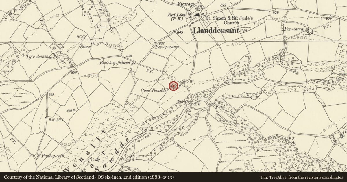
Slide toward Today to fade the historical sheet and see the modern map underneath.
David Rumsey Map Collection, Stanford LibrariesDavid Rumsey Map Collection, Stanford LibrariesDavid Rumsey Map Collection, Stanford LibrariesDavid Rumsey Map Collection, Stanford LibrariesDavid Rumsey Map Collection, Stanford Libraries
5 historical maps cover this location, the earliest the 1860 map "41. Caermathen." (David Rumsey Map Collection, Stanford Libraries).
Historical maps covering this location
- 1860 · 41. Caermathen. (David Rumsey Map Collection, Stanford Libraries)
- 1891 · Sheet 10. Ordnance Survey of England and Wales. . (David Rumsey Map Collection, Stanford Libraries)
- 1898 · 212 Llandovery (Outline) (David Rumsey Map Collection, Stanford Libraries)
- 1898 · 212 Llandovery (Hills) (David Rumsey Map Collection, Stanford Libraries)
- 1901 · Sheet 14. (David Rumsey Map Collection, Stanford Libraries)
Cadw's description
Location
Situated some 400m S of the parish church, on E side of lane to Blaensawdde.
History
Farmhouse, probably rebuilt in earlier C19 though site is recorded much earlier. Marked on 1841 Tithe map as owned by David Jenkins, occupied by Rees Davies with 35 acres ( 14.2ha).
Exterior
Farmhouse, whitened rubble stone, with slate roof and end stacks, larger to left, both with capstones and dripstones. Two-storey, three-window range much offset to right, such that door is well right of centre. C20 added matching window each floor to left. Windows are 12-pane sashes with stone voussoirs, door has similar voussoirs. Loft light in left end gable. Attached former outbuilding on left end has end wall rebuilt in cement block. Window and door to front.
Interior
Centre staircase, small parlour to right, large room to left with timber-lintel fireplace. Former dairy in rear outshut.
Reason for designation
Included as a good example of a traditional farmhouse of the later C18 to early C19, of group value with the range of outbuildings.
Nearby in the register
- Range of outbuildings at CwmsawddeAgriculture and Subsistenceunder 1 mi
- Church of St Simon and St JudeReligious, Ritual and Funeraryunder 1 mi
- Barn range at BlaensawddeAgriculture and Subsistenceunder 1 mi
- BlaensawddeDomesticunder 1 mi
Other entries of the same register within about three miles of this one, by straight line.