Cof Cymru: National Historic Assets of Wales · Wales
27-52 Park Terrace (consec)
Ynysawdre, Bridgend, Wales
A Grade II listed building in Tondu, Ynysawdre, Bridgend, designated on 9 November 1998.
The record
- Designation
- Listed building, Grade II
- Broad class
- Domestic
- Date of designation
- 9 November 1998
- Locality
- Tondu
- Community
- Ynysawdre
- Unitary authority
- Bridgend
- Country
- Wales
- Coordinates
- 51.54837, -3.60456
- Cadw reference
- 20807
Slide toward Today to fade the historical sheet and see the modern map underneath.
David Rumsey Map Collection, Stanford LibrariesDavid Rumsey Map Collection, Stanford LibrariesDavid Rumsey Map Collection, Stanford LibrariesDavid Rumsey Map Collection, Stanford LibrariesNational Library of Scotland
5 historical maps cover this location, the earliest the 1636 map "Cornubia : Devonia, Somersetus, Dorcestria, Wiltonia, Glocestria ..." (David Rumsey Map Collection, Stanford Libraries).
Historical maps covering this location
- 1636 · Cornubia : Devonia, Somersetus, Dorcestria, Wiltonia, Glocestria ... (David Rumsey Map Collection, Stanford Libraries)
- 1637 · The fourth table of England. Cornub. Devonia, Somerset etc. (David Rumsey Map Collection, Stanford Libraries)
- 1865 · England and Wales. England No. 6. (David Rumsey Map Collection, Stanford Libraries)
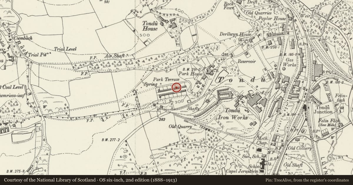
- 1884 · Glamorgan Sheet XXXIV (National Library of Scotland)
- 1907 · 248 Pontypridd (Hills) (David Rumsey Map Collection, Stanford Libraries)
Cadw's description
Location
At the extreme NW corner of the community adjoining open land to W and NW of former Tondu Ironworks.
History
Terraced housing built for the ironworkers to replace the early temporary wooden huts and known as company houses, the rent deducted from workers' wages. Constructed near the works, which were in operation day and night, in 1856 (dated at number 28) and thus shortly after John Brogden and Son took over the Ironworks in 1854 from Sir Robert Price who had established them in the 1830s.
Reason for designation
Listed in spite of some alterations as substantially intact terracing from the mid C19 unencumbered by later development in the area and for the close historical association with the early development of the nearby Tondu Ironworks, founded 1836, much of which is still extant.
Nearby in the register
- 27-52 Park Terrace (consec)Domesticunder 1 mi
- 27-52 Park Terrace (consec)Domesticunder 1 mi
- 27-52 Park Terrace (consec)Domesticunder 1 mi
- 27-52 Park Terrace (consec)Domesticunder 1 mi
Other entries of the same register within about three miles of this one, by straight line.