Cof Cymru: National Historic Assets of Wales · Wales
Springfield Cottage
Llangattock, Powys, Wales
A Grade II listed building in Dardy, Llangattock, Powys, designated on 21 October 1998.
The record
- Designation
- Listed building, Grade II
- Broad class
- Domestic
- Date of designation
- 21 October 1998
- Locality
- Dardy
- Community
- Llangattock
- Unitary authority
- Powys
- Country
- Wales
- Coordinates
- 51.85809, -3.15143
- Cadw reference
- 20733
Slide toward Today to fade the historical sheet and see the modern map underneath.
David Rumsey Map Collection, Stanford LibrariesDavid Rumsey Map Collection, Stanford LibrariesDavid Rumsey Map Collection, Stanford LibrariesDavid Rumsey Map Collection, Stanford LibrariesDavid Rumsey Map Collection, Stanford Libraries
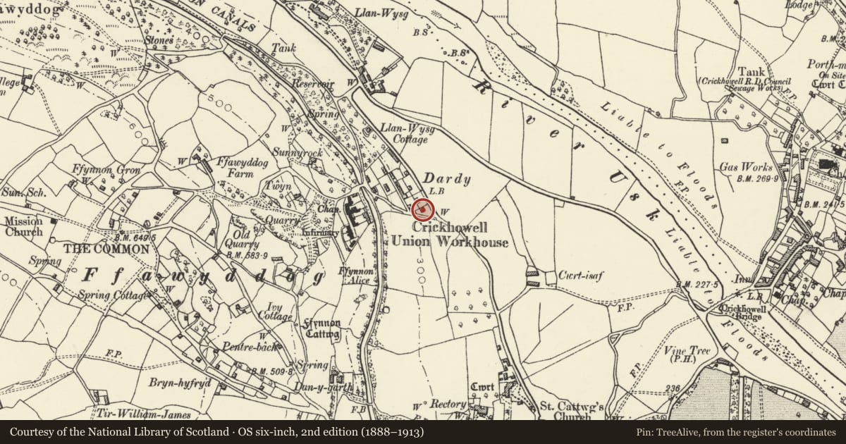
5 historical maps cover this location, the earliest the 1636 map "Cornubia : Devonia, Somersetus, Dorcestria, Wiltonia, Glocestria ..." (David Rumsey Map Collection, Stanford Libraries).
Historical maps covering this location
- 1636 · Cornubia : Devonia, Somersetus, Dorcestria, Wiltonia, Glocestria ... (David Rumsey Map Collection, Stanford Libraries)
- 1856 · 42. Brecon. (David Rumsey Map Collection, Stanford Libraries)
- 1898 · 232 Abergavenny (Hills) (David Rumsey Map Collection, Stanford Libraries)
- 1898 · 232 Abergavenny (Outline) (David Rumsey Map Collection, Stanford Libraries)
- 1901 · Sheet 14. (David Rumsey Map Collection, Stanford Libraries)
Cadw's description
Location
Located at the SE end of Dardy, a C19 settlement to the N of Llangattock village.
History
Mid to late C19 house shown on 1st edition Ordnance Survey of 1889. Replacing earlier cottages on the site belonging to the Duke of Beaufort.
Exterior
Three-window house with central gable. Two storeys and an attic. Rubble masonry with quoins under a slate roof with masonry end stacks. Lean-to to rear with N end stack. Wide boarded eaves and barge boards. Central lean-to porch of timber and latticework under a slate roof, flanked by wide 16-pane hornless sash windows, with red stone sills and lintels with matching hoodmoulds. There are similar windows in the upper storey, but the central window is narrower with 12 panes. Under the gable is a narrow multi-paned full dormer window. No openings to S gable end, eroded stone tablet in gable end. The later lean-to behind has C20 windows.
Interior
No access to interior at time of inspection (August 1997)
Reason for designation
Listed as a mid to late C19 cottage, one of the best preserved examples in Dardy and possibly associated with the Glanusk estate.
Nearby in the register
- Llan Wysg CottageDomesticunder 1 mi
- Cwrt LlangattockDomesticunder 1 mi
- Ice House at Llan WysgGardens, Parks and Urban Spacesunder 1 mi
- Llan WysgDomesticunder 1 mi
Other entries of the same register within about three miles of this one, by straight line.