Cof Cymru: National Historic Assets of Wales · Wales
Stable and Carriage House at Penmyarth
Llanfihangel Cwmdu with Bwlch and Cathedine, Powys, Wales
A Grade II listed building in Penmyarth, Llanfihangel Cwmdu with Bwlch and Cathedine, Powys, designated on 21 October 1998.
The record
- Designation
- Listed building, Grade II
- Broad class
- Domestic
- Date of designation
- 21 October 1998
- Locality
- Penmyarth
- Community
- Llanfihangel Cwmdu with Bwlch and Cathedine
- Unitary authority
- Powys
- Country
- Wales
- Coordinates
- 51.87345, -3.18096
- Cadw reference
- 20672
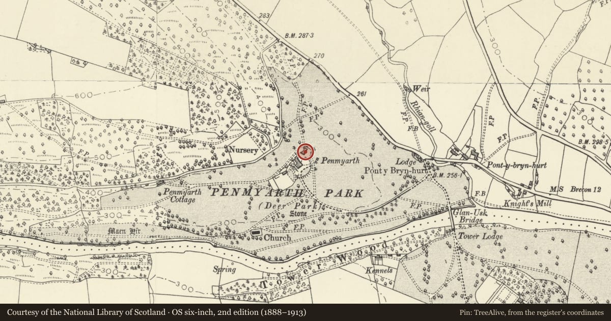
Slide toward Today to fade the historical sheet and see the modern map underneath.
David Rumsey Map Collection, Stanford LibrariesDavid Rumsey Map Collection, Stanford LibrariesDavid Rumsey Map Collection, Stanford LibrariesDavid Rumsey Map Collection, Stanford LibrariesDavid Rumsey Map Collection, Stanford Libraries
5 historical maps cover this location, the earliest the 1636 map "Cornubia : Devonia, Somersetus, Dorcestria, Wiltonia, Glocestria ..." (David Rumsey Map Collection, Stanford Libraries).
Historical maps covering this location
- 1636 · Cornubia : Devonia, Somersetus, Dorcestria, Wiltonia, Glocestria ... (David Rumsey Map Collection, Stanford Libraries)
- 1856 · 42. Brecon. (David Rumsey Map Collection, Stanford Libraries)
- 1895 · Sheet 11. Ordnance Survey of England and Wales. (David Rumsey Map Collection, Stanford Libraries)
- 1898 · 232 Abergavenny (Hills) (David Rumsey Map Collection, Stanford Libraries)
- 1901 · Sheet 14. (David Rumsey Map Collection, Stanford Libraries)
Cadw's description
Location
On NE side of Penmyarth house facing a service court.
History
Probably 1830s and built after the acquisition of Penmyarth Park by Joseph Bailey in 1831. Bailey incorporated Penmyarth into Glanusk Park on the S side of the Usk, which he had purchased in 1825. Penmyarth House was subsequently used by the agent of the Glanusk Estate, created in the 1840s largely out of enclosed common land.
Exterior
Single-storey, of roughcast walls painted white and slate roof. The carriage house to L has a wide doorway and a vent strip to its R. In the centre is an advanced bay under a gablet with an inserted clock in a shallow recess, and a cross window below with small-pane glazing. Further R is a boarded door with 3-pane overlight, and to R end is an advanced gabled bay with 2 cross windows. The R end wall has a 2-light casement lower R and a similar loft window to centre. Behind is an added lean-to.
Interior
Not inspected at time of survey (August 1997).
Reason for designation
Included for group value with Penmyarth, and an integral component of the surviving buildings on the Glanusk Estate.
Nearby in the register
- PenmyarthDomesticunder 1 mi
- Former Barn at PenmyarthAgriculture and Subsistenceunder 1 mi
- Penmyarth Park ChapelReligious, Ritual and Funeraryunder 1 mi
- North Lodge aka Glanusk LodgeDomesticunder 1 mi
Other entries of the same register within about three miles of this one, by straight line.