Cof Cymru: National Historic Assets of Wales · Wales
Wall N of Tretower Court Barn
Llanfihangel Cwmdu with Bwlch and Cathedine, Powys, Wales
A Grade II listed building in Tretower, Llanfihangel Cwmdu with Bwlch and Cathedine, Powys, designated on 21 October 1998.
The record
- Designation
- Listed building, Grade II
- Broad class
- Miscellaneous
- Date of designation
- 21 October 1998
- Locality
- Tretower
- Community
- Llanfihangel Cwmdu with Bwlch and Cathedine
- Unitary authority
- Powys
- Country
- Wales
- Coordinates
- 51.88368, -3.18371
- Cadw reference
- 20659
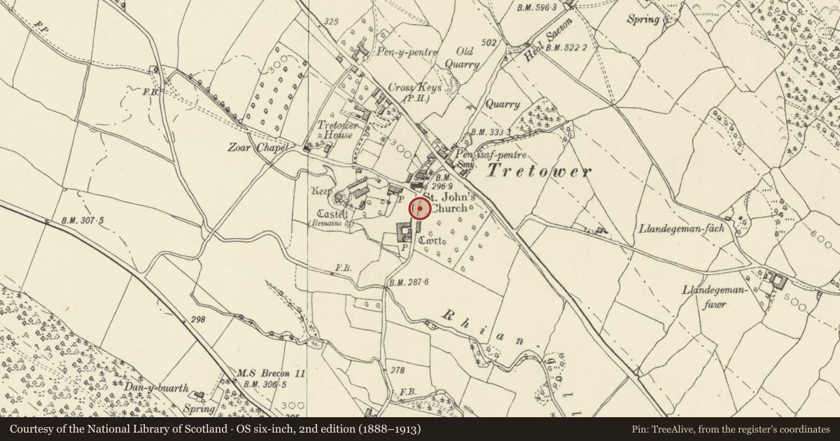
Slide toward Today to fade the historical sheet and see the modern map underneath.
David Rumsey Map Collection, Stanford LibrariesDavid Rumsey Map Collection, Stanford LibrariesDavid Rumsey Map Collection, Stanford LibrariesDavid Rumsey Map Collection, Stanford LibrariesDavid Rumsey Map Collection, Stanford Libraries
5 historical maps cover this location, the earliest the 1636 map "Cornubia : Devonia, Somersetus, Dorcestria, Wiltonia, Glocestria ..." (David Rumsey Map Collection, Stanford Libraries).
Historical maps covering this location
- 1636 · Cornubia : Devonia, Somersetus, Dorcestria, Wiltonia, Glocestria ... (David Rumsey Map Collection, Stanford Libraries)
- 1856 · 42. Brecon. (David Rumsey Map Collection, Stanford Libraries)
- 1895 · Sheet 11. Ordnance Survey of England and Wales. (David Rumsey Map Collection, Stanford Libraries)
- 1896 · 214 Talgarth (Hills) (David Rumsey Map Collection, Stanford Libraries)
- 1901 · Sheet 14. (David Rumsey Map Collection, Stanford Libraries)
Cadw's description
Location
On E side of minor road through Tretower immediately N of Tretower Court Barn.
History
Built probably c1480 when Sir Thomas Vaughan added the gatehouse and curtain wall to Tretower Court. The wall was part of a long range built opposite Thomas Vaughan's entrance to Tretower Court, which survives in a shortened form as Tretower Court Barn. The range perhaps comprised a dwelling for retainers and stables. At the N end of the original building a wall, embattled and incorporating a main gateway and a postern, spanned the road and linked with a boundary wall on the opposite side.
Exterior
Rubble sandstone wall approximately 12m long, 2m high and 0.8m thick. One tall narrow breather has a splayed reveal.
Reason for designation
Included for group value with Tretower Court, a medieval house of national importance.
Nearby in the register
- Wall N of Tretower CourtMiscellaneousunder 1 mi
- Tretower Court BarnAgriculture and Subsistenceunder 1 mi
- Tretower BarnBarnunder 1 mi
- Church of St John the EvangelistReligious, Ritual and Funeraryunder 1 mi
Other entries of the same register within about three miles of this one, by straight line.