Cof Cymru: National Historic Assets of Wales · Wales
Telephone Call-box at Hafod
Pentrefoelas, Conwy, Wales
A Grade II listed building in Hafod, Pentrefoelas, Conwy, designated on 19 October 1998.
The record
- Designation
- Listed building, Grade II
- Broad class
- Commercial
- Date of designation
- 19 October 1998
- Locality
- Hafod
- Town
- Pentrefoelas
- Community
- Pentrefoelas
- Unitary authority
- Conwy
- Country
- Wales
- Coordinates
- 53.06466, -3.65401
- Cadw reference
- 20598
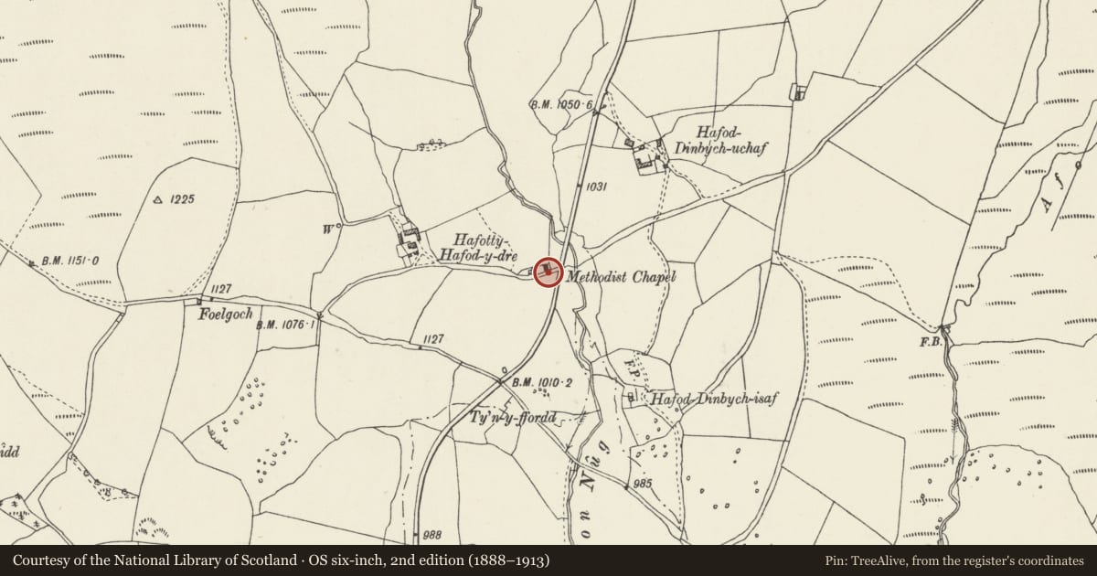
Slide toward Today to fade the historical sheet and see the modern map underneath.
David Rumsey Map Collection, Stanford LibrariesDavid Rumsey Map Collection, Stanford LibrariesLlyfrgell Genedlaethol Cymru – The National Library of WalesDavid Rumsey Map Collection, Stanford LibrariesDavid Rumsey Map Collection, Stanford Libraries
5 historical maps cover this location, the earliest the 1795 map "To Sir Watkin Williams-Wynn Bart ... the map of the six counties of North Wales is most humbly inscribed by his obedient humble servant" (Llyfrgell Genedlaethol Cymru – The National Library of Wales).
Historical maps covering this location
- 1795 · To Sir Watkin Williams-Wynn Bart ... the map of the six counties of North Wales is most… (Llyfrgell Genedlaethol Cymru – The National Library of Wales)
- 1830 · V.3:11-15:XV. Britisches Reich. A. Kon: England. b. Frstenthum Wales: Shire: 37-40 (David Rumsey Map Collection, Stanford Libraries)
- 1883 · Watershed map England, Wales 3. (David Rumsey Map Collection, Stanford Libraries)
- 1898 · 120 Corwen (Hills) (David Rumsey Map Collection, Stanford Libraries)
- 1901 · Sheet 9 and 10. (David Rumsey Map Collection, Stanford Libraries)
Cadw's description
Location
Hafod is at a remote crossroads on the edge of open moorland 2.75km from the junction with the A5 Holyhead Road. The call box is located close to the end of the small chapel.
Exterior
K6 pattern standard cast iron public telephone call box with a domed roof and 4 lunettes containing embossed crowns over red lettered opals and ventilation slits, a derivative of the original design of 1936 by Giles Gilbert Scott, and made by Carron Co. Scotland, and erected for the GPO after 1936. Rear blank, with the Mark 2 asymmetrical cable entry slots. The internal equipment modernised.
Reason for designation
Included as a prominently sited red telephone call-box serving this remote moorland settlement, included for group value with the adjacent chapel and Glanrafon cottages.
Nearby in the register
- Chapel at HafodReligious, Ritual and Funeraryunder 1 mi
- GlanrafonDomesticunder 1 mi
- Hafod-y-Dre Stone Rows and CairnStone Alignmentunder 1 mi
- Tyrpeg MynyddDomesticunder 1 mi
Other entries of the same register within about three miles of this one, by straight line.