Cof Cymru: National Historic Assets of Wales · Wales
Capel Elim
Rhosyr, Isle of Anglesey, Wales
A Grade II listed building in Dwyran, Rhosyr, Isle of Anglesey, designated on 19 October 1998.
The record
- Designation
- Listed building, Grade II
- Broad class
- Domestic
- Date of designation
- 19 October 1998
- Locality
- Dwyran
- Community
- Rhosyr
- Unitary authority
- Isle of Anglesey
- Country
- Wales
- Coordinates
- 53.16738, -4.32202
- Cadw reference
- 20569
Slide toward Today to fade the historical sheet and see the modern map underneath.
David Rumsey Map Collection, Stanford LibrariesDavid Rumsey Map Collection, Stanford LibrariesDavid Rumsey Map Collection, Stanford LibrariesDavid Rumsey Map Collection, Stanford LibrariesDavid Rumsey Map Collection, Stanford Libraries
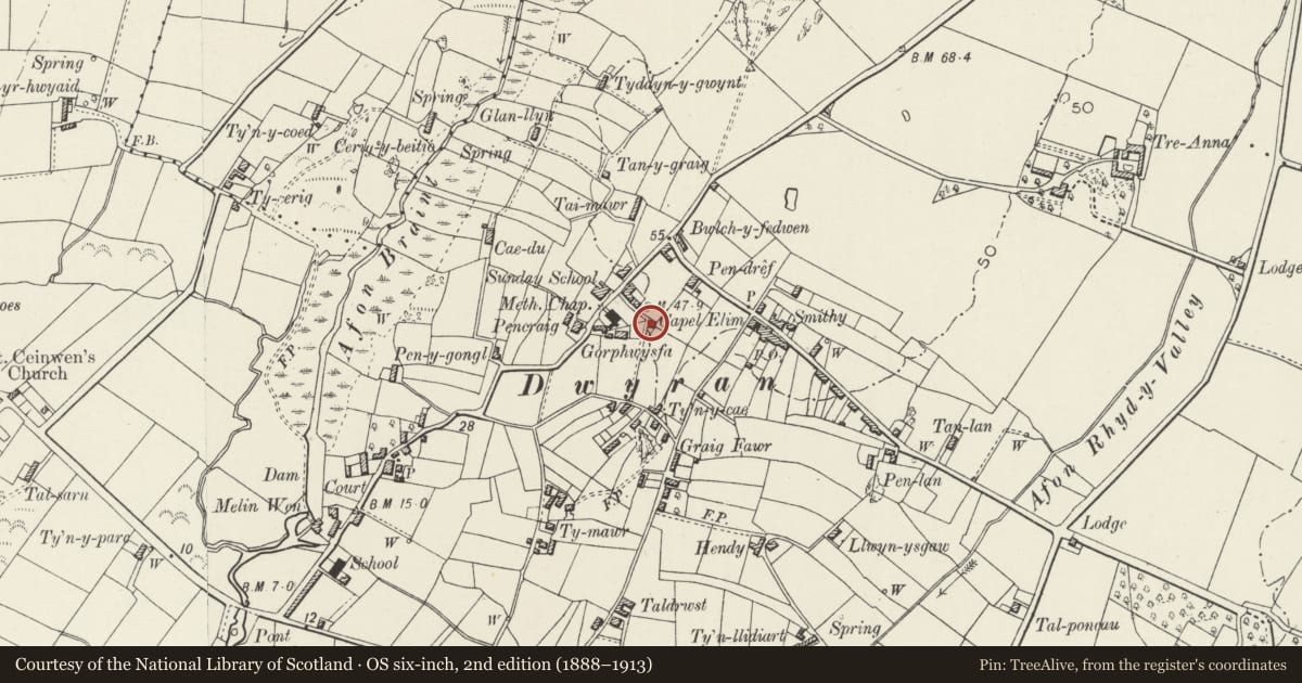
5 historical maps cover this location, the earliest the 1883 map "Watershed map England, Wales 3." (David Rumsey Map Collection, Stanford Libraries).
Historical maps covering this location
- 1883 · Watershed map England, Wales 3. (David Rumsey Map Collection, Stanford Libraries)
- 1896 · Sheet 7. Ordnance Survey of England and Wales. (David Rumsey Map Collection, Stanford Libraries)
- 1899 · 105 Carnarvon (Hills) (David Rumsey Map Collection, Stanford Libraries)
- 1901 · Sheet 9 and 10. (David Rumsey Map Collection, Stanford Libraries)
- 1919 · Sheet 41. Anglesey. (David Rumsey Map Collection, Stanford Libraries)
Cadw's description
Location
Set well back from the SE side of the main road through Dwyran, in an isolated position reached only by footpath, to the rear of Dwyran Methodist Chapel.
History
Mid C19. The name derives from a chapel of this name which was recorded in the village in 1851. It is not however known whether this building was ever in use as either chapel or chapel house.
.
Exterior
A single-storey vernacular cottage. Built of rubble masonry on boulder foundations. Roof of old small slates, grouted, with tiled ridge and copings and rendered gable stacks (that to right a dummy stack). The entrance is in the NE wall, 2-windows with doorway between, openings offset to left (SE) end. Windows are slightly recessed 4-pane sashes set under the eaves, and there are 2 similarly detailed in the rear (SW) wall.
Interior
The cottage has a boarded partition (a later addition) to the right of the door, 2 doorways leading to a pantry and bedroom. To the left is a living room containing a boarded wainscot.
Reason for designation
Listed as a well-preserved late example of a small, single-storey cottage (a type once common on Anglesey) which retains much of its vernacular character.
Nearby in the register
- YsgoldyEducationunder 1 mi
- Church of St Mary, Llanfair-yn-CwmwdReligious, Ritual and Funeraryunder 1 mi
- Church of St CeinwenReligious, Ritual and Funeraryunder 1 mi
- Cae'r LlechauDomesticunder 1 mi
Other entries of the same register within about three miles of this one, by straight line.