Cof Cymru: National Historic Assets of Wales · Wales
Dam above the Raby Furnace
Llanelli Rural, Carmarthenshire, Wales
A Grade II listed building in Furnace, Llanelli, Llanelli Rural, Carmarthenshire, designated on 16 October 1998.
The record
- Designation
- Listed building, Grade II
- Broad class
- Industrial
- Date of designation
- 16 October 1998
- Locality
- Furnace
- Town
- Llanelli
- Community
- Llanelli Rural
- Unitary authority
- Carmarthenshire
- Country
- Wales
- Coordinates
- 51.69349, -4.16590
- Cadw reference
- 20535
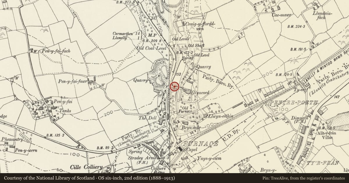
Slide toward Today to fade the historical sheet and see the modern map underneath.
David Rumsey Map Collection, Stanford LibrariesDavid Rumsey Map Collection, Stanford LibrariesNational Library of ScotlandDavid Rumsey Map Collection, Stanford LibrariesDavid Rumsey Map Collection, Stanford Libraries
5 historical maps cover this location, the earliest the 1636 map "Cornubia : Devonia, Somersetus, Dorcestria, Wiltonia, Glocestria ..." (David Rumsey Map Collection, Stanford Libraries).
Historical maps covering this location
- 1636 · Cornubia : Devonia, Somersetus, Dorcestria, Wiltonia, Glocestria ... (David Rumsey Map Collection, Stanford Libraries)
- 1637 · The fourth table of England. Cornub. Devonia, Somerset etc. (David Rumsey Map Collection, Stanford Libraries)
- 1891 · Sheet 10. Ordnance Survey of England and Wales. . (David Rumsey Map Collection, Stanford Libraries)
- 1920 · Sheet 100. Llanelly. (David Rumsey Map Collection, Stanford Libraries)
- 1963 · Map No. 4 - Local Government Commission for Wales : [Definitive maps showing proposed… (National Library of Scotland)
Cadw's description
Location
Carrying part of the minor road which joins the B4309 about 120 m north of the furnace.
History
Probably providing water power for Raby's furnace, this dam was either built by Raby c.1800 or dates from an earlier industrial use of the site.
Exterior
A dam, the masonry of which is similar to that of the Raby furnace. It is probable that the pool held by this dam was the source of water power for blowing the furnace. In the south face there are several arched openings near the east bank and a tunnel at high level. The water is now released through a modern spillway into an old culvert.
Water was probably drawn from the pool under the control of a sluice, and carried at high level to a waterwheel connected to bellows at the furnace.
The culvert which now conducts the whole stream from this dam past the furnace has been excavated and appears to be contemporary with the furnace.
Reason for designation
Listed for group value with the Raby furnace, and as part of the power system associated with it.
Nearby in the register
- Raby's FurnaceIron forgeunder 1 mi
- The Raby FurnaceIndustrialunder 1 mi
- Sir Arthur Stepney Memorial in Old Road CemeteryCommemorativeunder 1 mi
- GreylandsDomesticunder 1 mi
Other entries of the same register within about three miles of this one, by straight line.