Cof Cymru: National Historic Assets of Wales · Wales
Cross in Churchyard of the Church of St Mary
Portskewett, Monmouthshire, Wales
A Grade II listed building in Portskewett, Newport, Monmouthshire, designated on 19 August 1955.
The record
- Designation
- Listed building, Grade II
- Broad class
- Religious, Ritual and Funerary
- Date of designation
- 19 August 1955
- Locality
- Portskewett
- Town
- Newport
- Community
- Portskewett
- Unitary authority
- Monmouthshire
- Country
- Wales
- Coordinates
- 51.58994, -2.72451
- Cadw reference
- 2045
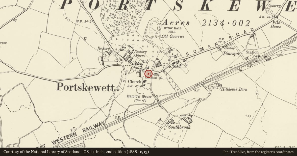
Slide toward Today to fade the historical sheet and see the modern map underneath.
David Rumsey Map Collection, Stanford LibrariesDavid Rumsey Map Collection, Stanford LibrariesDavid Rumsey Map Collection, Stanford LibrariesDavid Rumsey Map Collection, Stanford LibrariesDavid Rumsey Map Collection, Stanford Libraries
5 historical maps cover this location, the earliest the 1636 map "Cornubia : Devonia, Somersetus, Dorcestria, Wiltonia, Glocestria ..." (David Rumsey Map Collection, Stanford Libraries).
Historical maps covering this location
- 1636 · Cornubia : Devonia, Somersetus, Dorcestria, Wiltonia, Glocestria ... (David Rumsey Map Collection, Stanford Libraries)
- 1895 · Sheet 11. Ordnance Survey of England and Wales. (David Rumsey Map Collection, Stanford Libraries)
- 1897 · 250 Chepstow (Outline) (David Rumsey Map Collection, Stanford Libraries)
- 1905 · 250 Chepstow (Hills) (David Rumsey Map Collection, Stanford Libraries)
- 1913 · Sheet 102. Newport. (David Rumsey Map Collection, Stanford Libraries)
Cadw's description
Location
In the churchyard about 40m north east of the Church of St Mary.
History
A late medieval preaching cross, dating probably from the late C15.
Exterior
Medieval limestone square plan cross base with five diminishing steps, very weathered, square socket stone with the damaged remains of the shaft.
Reason for designation
Included as an important medieval cross having strong group value with the adjacent Church of St Mary.
Nearby in the register
- St. Mary's Churchyard Cross, PortskewettCrossunder 1 mi
- Portskewett War MemorialCommemorativeunder 1 mi
- Church of St MaryReligious, Ritual and Funeraryunder 1 mi
- Old Cottage/Storehouse in Churchyard of Church of St MaryDomesticunder 1 mi
Other entries of the same register within about three miles of this one, by straight line.