Cof Cymru: National Historic Assets of Wales · Wales
Stone Bridge to west of Watermill
Llandwrog, Gwynedd, Wales
A Grade II listed building in Glynllifon, Llandwrog, Gwynedd, designated on 8 September 1998.
The record
- Designation
- Listed building, Grade II
- Broad class
- Gardens, Parks and Urban Spaces
- Date of designation
- 8 September 1998
- Locality
- Glynllifon
- Community
- Llandwrog
- Unitary authority
- Gwynedd
- Country
- Wales
- Coordinates
- 53.07259, -4.30781
- Cadw reference
- 20445
Slide toward Today to fade the historical sheet and see the modern map underneath.
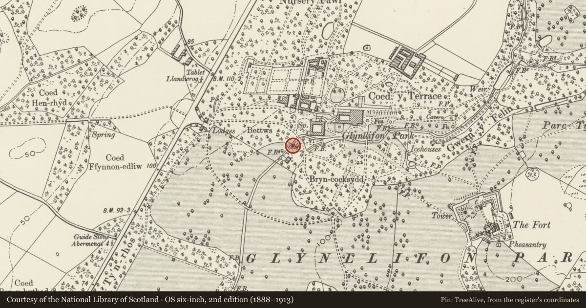
David Rumsey Map Collection, Stanford LibrariesDavid Rumsey Map Collection, Stanford LibrariesDavid Rumsey Map Collection, Stanford LibrariesDavid Rumsey Map Collection, Stanford LibrariesLlyfrgell Genedlaethol Cymru – The National Library of Wales
5 historical maps cover this location, the earliest the 1795 map "To Sir Watkin Williams-Wynn Bart ... the map of the six counties of North Wales is most humbly inscribed by his obedient humble servant" (Llyfrgell Genedlaethol Cymru – The National Library of Wales).
Historical maps covering this location
- 1795 · To Sir Watkin Williams-Wynn Bart ... the map of the six counties of North Wales is most… (Llyfrgell Genedlaethol Cymru – The National Library of Wales)
- 1883 · Watershed map England, Wales 3. (David Rumsey Map Collection, Stanford Libraries)
- 1896 · Sheet 7. Ordnance Survey of England and Wales. (David Rumsey Map Collection, Stanford Libraries)
- 1899 · 118 Nevin (Hills) (David Rumsey Map Collection, Stanford Libraries)
- 1901 · Sheet 9 and 10. (David Rumsey Map Collection, Stanford Libraries)
Cadw's description
Location
Spanning the Afon Llifon immediately adjacent to the watermill. Carries track from main west drive into yard behind mill. Attached to the L-shaped range adjoining the watermill to west.
History
Part of the mid C19 development of the Glynllifon estate by the 3rd Lord Newborough.
Glynllifon was the seat of the Wynn family and Sir Thomas John Wynn became the 1st Lord Newborough in 1776. The house was rebuilt after a fire 1836-48 by Edward Haycock, architect of Shrewsbury.
Exterior
Small low arched coursed stone bridge with parapets and dressed stone coping. End piers are capped by massive slate slabs. Voussoirs and regulating course to arch.
Reason for designation
Included for group value with neighbouring listed items at Glynllifon.
Nearby in the register
- Watermill to south-west of Stables including archway into mill yard and attached L-shaped rangeAgriculture and Subsistenceunder 1 mi
- Stone-walled leat adjoining north-east side of Watermill at GlynllifonDomesticunder 1 mi
- Stone Bridge on the main drive south of the Stables at GlynllifonDomesticunder 1 mi
- Hay-barn to south of WatermillAgriculture and Subsistenceunder 1 mi
Other entries of the same register within about three miles of this one, by straight line.