Cof Cymru: National Historic Assets of Wales · Wales
Garden terrace and water feature in front of Bodorgan Hall
Bodorgan, Isle of Anglesey, Wales
A Grade II listed building in Bodorgan, Isle of Anglesey, designated on 3 September 1998.
The record
- Designation
- Listed building, Grade II
- Broad class
- Gardens, Parks and Urban Spaces
- Date of designation
- 3 September 1998
- Locality
- Bodorgan
- Community
- Bodorgan
- Unitary authority
- Isle of Anglesey
- Country
- Wales
- Coordinates
- 53.17880, -4.41621
- Cadw reference
- 20413
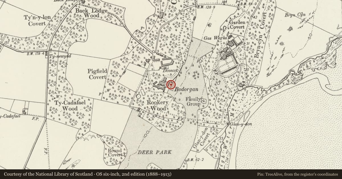
Slide toward Today to fade the historical sheet and see the modern map underneath.
David Rumsey Map Collection, Stanford LibrariesDavid Rumsey Map Collection, Stanford LibrariesDavid Rumsey Map Collection, Stanford LibrariesDavid Rumsey Map Collection, Stanford LibrariesDavid Rumsey Map Collection, Stanford Libraries
5 historical maps cover this location, the earliest the 1883 map "Watershed map England, Wales 3." (David Rumsey Map Collection, Stanford Libraries).
Historical maps covering this location
- 1883 · Watershed map England, Wales 3. (David Rumsey Map Collection, Stanford Libraries)
- 1896 · Sheet 7. Ordnance Survey of England and Wales. (David Rumsey Map Collection, Stanford Libraries)
- 1899 · 105 Carnarvon (Hills) (David Rumsey Map Collection, Stanford Libraries)
- 1901 · Sheet 9 and 10. (David Rumsey Map Collection, Stanford Libraries)
- 1919 · Sheet 41. Anglesey. (David Rumsey Map Collection, Stanford Libraries)
Cadw's description
Location
Formal terraced garden to the E of, and overlooked by, Bodorgan Hall, set above the deer park and with views over the Malltraeth estuary.
History
Formal terraced garden, constructed c.1830, during a period of improvements to Bodorgan for Owen Fuller Meyrick. During this period the main entrance to the house was moved from the centre of the bow on the SE side to the NE side. Two wings of soft yellow sandstone built; one an orangery, the other an aviary. The balustered terraced garden replaced the old driveway to the house, and a second, smaller garden was laid out in front of the SW wing.
Bodorgan was one of a number of townships from which the Bishop of Bangor derived his income, and is first recorded in 1306. The estate forms the Anglesey seat of the Meyrick family, whose ancestors were tenants from late C14, the surname first documented in 1537. The estate expanded greatly from the early C18 onwards, and by late C19 was the largest on the island.
Exterior
Semicircular balustraded terrace with central water feature; Limestone walls, square piers with raised panels, interspersed with shaped balusters, under a moulded cornice. In front of the bowed front of the main house is a water feature with fountain set in a domed recess with radiating decoration in relief; flanking stairs to lower terrace. Low terrace walls supporting balustrading continue along the front of the house to either side of this central feature, bounding the entrance court and the SW garden.
Reason for designation
Listed as a significant, defining element in the formal gardens which are an integral part of the mansion house at Bodorgan. The garden dates from a significant period of alterations and additions to the house by Owen Fuller Meyrick c1830.
Nearby in the register
- BodorganDomesticunder 1 mi
- Privy block at Bodorgan home farmDomesticunder 1 mi
- Dovecote at Bodorgan home farmDomesticunder 1 mi
- Former corn barn and stable range of Bodorgan home farmAgriculture and Subsistenceunder 1 mi
Other entries of the same register within about three miles of this one, by straight line.