Cof Cymru: National Historic Assets of Wales · Wales
Llwynisgaw
Bodorgan, Isle of Anglesey, Wales
A Grade II listed building in Cwnhingar Trefri, Bodorgan, Isle of Anglesey, designated on 3 September 1998.
The record
- Designation
- Listed building, Grade II
- Broad class
- Domestic
- Date of designation
- 3 September 1998
- Locality
- Cwnhingar Trefri
- Community
- Bodorgan
- Unitary authority
- Isle of Anglesey
- Country
- Wales
- Coordinates
- 53.18230, -4.44014
- Cadw reference
- 20411
Slide toward Today to fade the historical sheet and see the modern map underneath.
David Rumsey Map Collection, Stanford LibrariesDavid Rumsey Map Collection, Stanford LibrariesDavid Rumsey Map Collection, Stanford LibrariesDavid Rumsey Map Collection, Stanford LibrariesDavid Rumsey Map Collection, Stanford Libraries
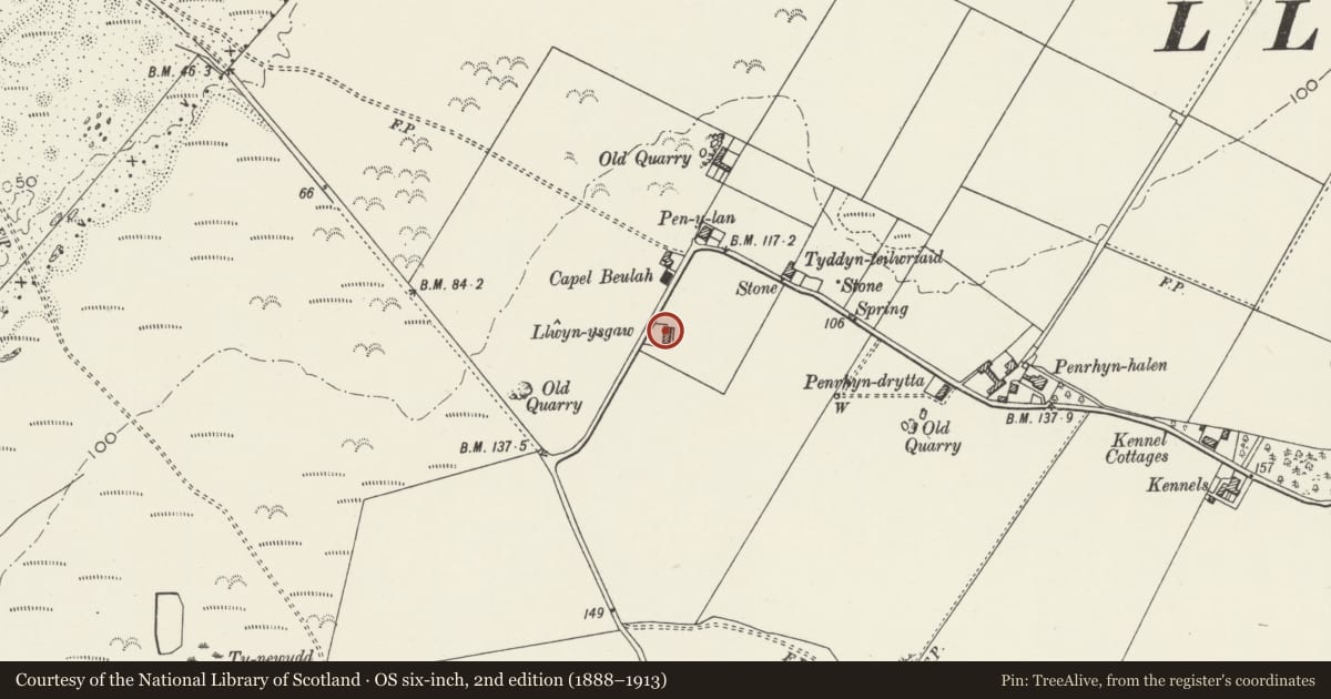
5 historical maps cover this location, the earliest the 1883 map "Watershed map England, Wales 3." (David Rumsey Map Collection, Stanford Libraries).
Historical maps covering this location
- 1883 · Watershed map England, Wales 3. (David Rumsey Map Collection, Stanford Libraries)
- 1896 · Sheet 7. Ordnance Survey of England and Wales. (David Rumsey Map Collection, Stanford Libraries)
- 1899 · 105 Carnarvon (Hills) (David Rumsey Map Collection, Stanford Libraries)
- 1901 · Sheet 9 and 10. (David Rumsey Map Collection, Stanford Libraries)
- 1919 · Sheet 41. Anglesey. (David Rumsey Map Collection, Stanford Libraries)
Cadw's description
Location
In a rural location set back from the SE side of a country road, running between Hermon and Aberffraw S of the A4080; c. 2km SW of the church of St. Cadwaladr.
History
Late C18 or early C19 vernacular farmhouse. Shown on the Llangadwaladr Tithe map of 1843.
Exterior
A 2-storey, 2-window range, the principal elevation facing E (away from the road) with central porch; single storey addition to right (N) and modern garage to left (S). Built of rubble masonry; slate roof with stone copings and rendered gable stacks. Windows are slightly recessed sashes; first floor windows set under the eaves, ground floor windows larger, the front elevation with small-pane lights, rear elevation with stair window offset to left (N).
Reason for designation
Listed as a well-preserved example of a late C18/early C19 two-storey farmhouse, retaining its vernacular character in scale and layout and use of materials.
Nearby in the register
- TreberfeddDomesticunder 1 mi
- The KennelsDomesticunder 1 mi
- Back Lodge at BodorganDomesticunder 1 mi
- Cattle weigh-house at Bodorgan home farmAgriculture and Subsistenceunder 1 mi
Other entries of the same register within about three miles of this one, by straight line.