Cof Cymru: National Historic Assets of Wales · Wales
Cyffredyn Cottage
Llangynidr, Powys, Wales
A Grade II listed building in Cyffredyn, Llangynidr, Powys, designated on 28 August 1998.
The record
- Designation
- Listed building, Grade II
- Broad class
- Domestic
- Date of designation
- 28 August 1998
- Locality
- Cyffredyn
- Community
- Llangynidr
- Unitary authority
- Powys
- Country
- Wales
- Coordinates
- 51.87043, -3.21302
- Cadw reference
- 20382
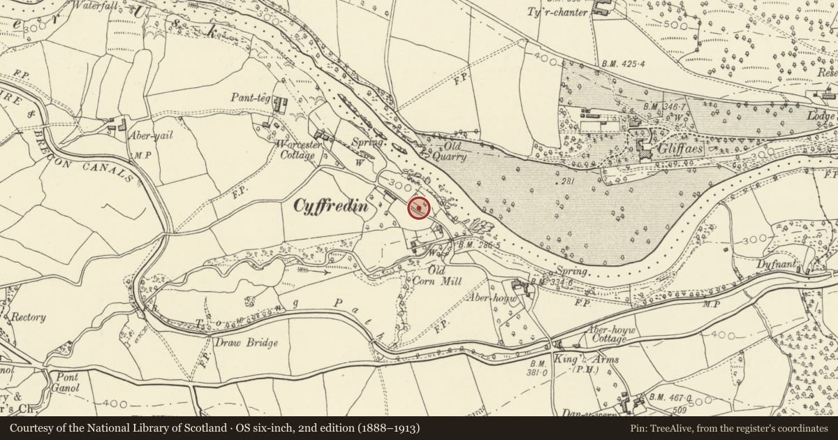
Slide toward Today to fade the historical sheet and see the modern map underneath.
David Rumsey Map Collection, Stanford LibrariesDavid Rumsey Map Collection, Stanford LibrariesDavid Rumsey Map Collection, Stanford LibrariesDavid Rumsey Map Collection, Stanford LibrariesDavid Rumsey Map Collection, Stanford Libraries
5 historical maps cover this location, the earliest the 1636 map "Cornubia : Devonia, Somersetus, Dorcestria, Wiltonia, Glocestria ..." (David Rumsey Map Collection, Stanford Libraries).
Historical maps covering this location
- 1636 · Cornubia : Devonia, Somersetus, Dorcestria, Wiltonia, Glocestria ... (David Rumsey Map Collection, Stanford Libraries)
- 1856 · 42. Brecon. (David Rumsey Map Collection, Stanford Libraries)
- 1898 · 232 Abergavenny (Hills) (David Rumsey Map Collection, Stanford Libraries)
- 1898 · 232 Abergavenny (Outline) (David Rumsey Map Collection, Stanford Libraries)
- 1901 · Sheet 14. (David Rumsey Map Collection, Stanford Libraries)
Cadw's description
Location
Half a mile east of Llangynidr, on N side of, and set back from Cyffredyn Lane.
History
Built on land leased from the Beaufort Estate in 1858, on condition that a dwelling was built within 12 months, and that earlier buildings shown on the 1760 Estate Map and 1840 Tithe Map were cleared. Shown on First Edition Ordnance Survey Map.
Exterior
Two-storey cottage of rubble sandstone and slate roof. End stone stack to R. Two-window front with openings under stone lintels with hood moulds, and comprising 9-pane sashes in the upper storey, 12-pane in the lower storey, with central boarded door. Lean-to to R and continuous outshut at rear are later additions in rubble stone with slate roofs.
Interior
Not inspected at time of resurvey, July 1997.
Reason for designation
Included as a later C19 cottage retaining original character and for group value with Usk Cottage.
Nearby in the register
- Usk CottageDomesticunder 1 mi
- AberhoywDomesticunder 1 mi
- Old House Bridge (Canal Bridge No 127)Transportunder 1 mi
- Aberhoyw Bridge (Canal Bridge No 126)Transportunder 1 mi
Other entries of the same register within about three miles of this one, by straight line.