Cof Cymru: National Historic Assets of Wales · Wales
Llwyncelyn
Llangynidr, Powys, Wales
A Grade II listed building in Llwyncelyn Farm, Llangynidr, Powys, designated on 28 August 1998.
The record
- Designation
- Listed building, Grade II
- Broad class
- Domestic
- Date of designation
- 28 August 1998
- Locality
- Llwyncelyn Farm
- Community
- Llangynidr
- Unitary authority
- Powys
- Country
- Wales
- Coordinates
- 51.86304, -3.21882
- Cadw reference
- 20377
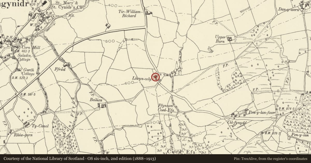
Slide toward Today to fade the historical sheet and see the modern map underneath.
David Rumsey Map Collection, Stanford LibrariesDavid Rumsey Map Collection, Stanford LibrariesDavid Rumsey Map Collection, Stanford LibrariesDavid Rumsey Map Collection, Stanford LibrariesDavid Rumsey Map Collection, Stanford Libraries
5 historical maps cover this location, the earliest the 1636 map "Cornubia : Devonia, Somersetus, Dorcestria, Wiltonia, Glocestria ..." (David Rumsey Map Collection, Stanford Libraries).
Historical maps covering this location
- 1636 · Cornubia : Devonia, Somersetus, Dorcestria, Wiltonia, Glocestria ... (David Rumsey Map Collection, Stanford Libraries)
- 1856 · 42. Brecon. (David Rumsey Map Collection, Stanford Libraries)
- 1898 · 232 Abergavenny (Hills) (David Rumsey Map Collection, Stanford Libraries)
- 1898 · 232 Abergavenny (Outline) (David Rumsey Map Collection, Stanford Libraries)
- 1901 · Sheet 14. (David Rumsey Map Collection, Stanford Libraries)
Cadw's description
Location
0.8km SW of Llangynidr church and reached by private road S of B4560.
History
Late C17 house with byre attached, to which a rear range was added C19, creating a new front facing away from the farm yard.
Exterior
Two-storey house with attached byre (now stable) under a continuous roof, with shorter parallel rear range. Of random rubble walls battered at the base, with traces of limewash and openings under timber lintels. Slate roof with end stone stack to L. The house to L is double fronted with openings offset to R. Sash windows are renewed in original openings, and in window inserted above the doorway. The doorway has brackets of a former canopy and a replaced front door. The stable to R has a rare surviving pentice, a feature characteristice of this region, renewed slate roof. To R is a doorway with boarded door, with small opening to its L. Three-window rear range with end stone stacks. Stone-walled forecourt to farmhouse.
Interior
Not accessible at time of inspection, August 1997.
Reason for designation
Listed for its special interest as a farmhouse and byre of C17 origin retaining original plan form and pentice.
Nearby in the register
- Old House Bridge (Canal Bridge No 127)Transportunder 1 mi
- Bridge over Nant CleisferTransportunder 1 mi
- War Memorial at SS Cynidr & Mary ChurchReligious, Ritual and Funeraryunder 1 mi
- Llangynidr Deserted Medieval Village (part of)Deserted Medieval Villageunder 1 mi
Other entries of the same register within about three miles of this one, by straight line.