Cof Cymru: National Historic Assets of Wales · Wales
Lower Pendre
Llangors, Powys, Wales
A Grade II listed building in Llangors, Powys, designated on 21 August 1998.
The record
- Designation
- Listed building, Grade II
- Broad class
- Domestic
- Date of designation
- 21 August 1998
- Locality
- Llangors
- Community
- Llangors
- Unitary authority
- Powys
- Country
- Wales
- Coordinates
- 51.94451, -3.26083
- Cadw reference
- 20341
Slide toward Today to fade the historical sheet and see the modern map underneath.
David Rumsey Map Collection, Stanford LibrariesDavid Rumsey Map Collection, Stanford LibrariesDavid Rumsey Map Collection, Stanford LibrariesDavid Rumsey Map Collection, Stanford LibrariesDavid Rumsey Map Collection, Stanford Libraries
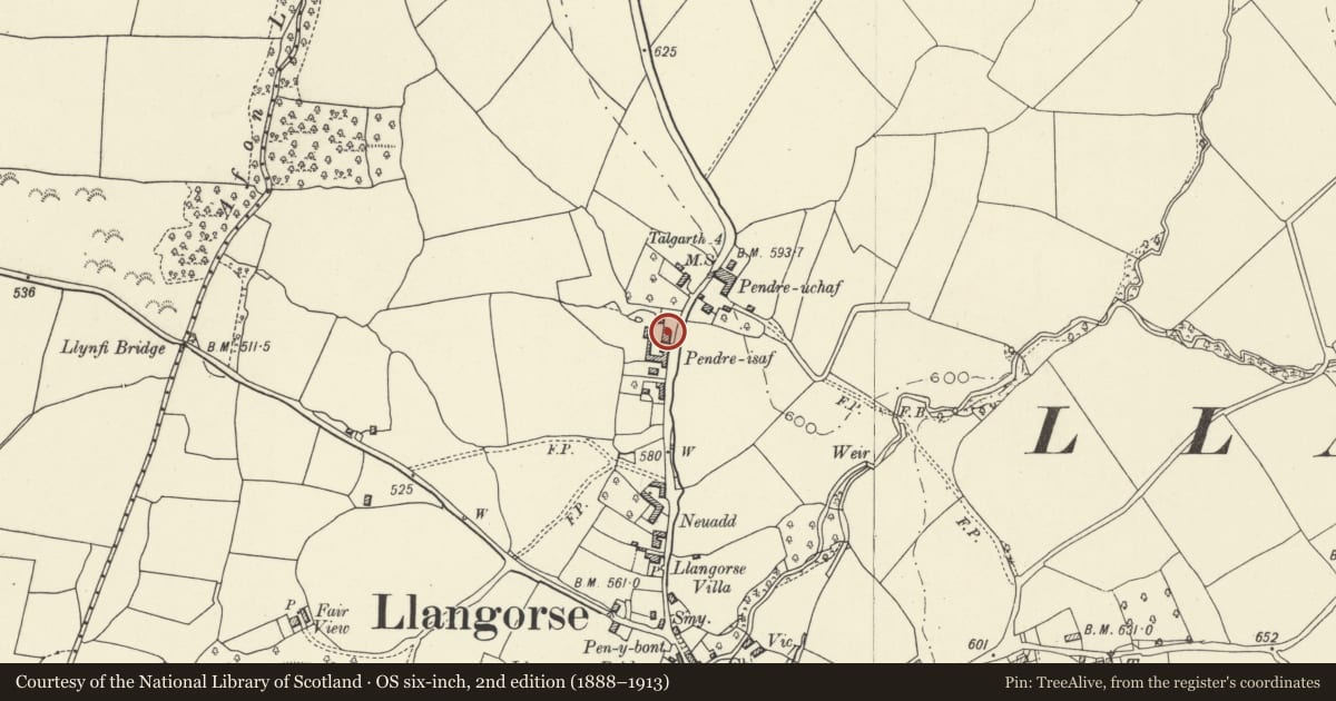
5 historical maps cover this location, the earliest the 1608 map "(13) Cambriae Typus." (David Rumsey Map Collection, Stanford Libraries).
Historical maps covering this location
- 1608 · (13) Cambriae Typus. (David Rumsey Map Collection, Stanford Libraries)
- 1636 · Cornubia : Devonia, Somersetus, Dorcestria, Wiltonia, Glocestria ... (David Rumsey Map Collection, Stanford Libraries)
- 1856 · 42. Brecon. (David Rumsey Map Collection, Stanford Libraries)
- 1896 · 214 Talgarth (Hills) (David Rumsey Map Collection, Stanford Libraries)
- 1901 · Sheet 14. (David Rumsey Map Collection, Stanford Libraries)
Cadw's description
Location
Towards the N end of Llangors village on W side of main street.
History
Earlier C17 with C19 remodelling.
Exterior
Village farmhouse of roughcast stone with steep pitched Welsh slate roof with terracotta ridge tiles and distinctive end chimney stacks, diagonally-set to left. T- shaped plan with central cross passage. Two storeys and attic, with paired gabled dormers to front; three window range of C19 casements with some later replacements, slighly cambered heads to first floor; front gabled porch. Two storey gabled cross staircase wing to rear has windows with timber lintels on 3 storeys including small pane apex light, porch adjacent.
Interior
Interior retains central cross passage with screen in situ; rear passage at right angles separates staircase wing, the staircase with open well, balustrades and shaped doorhead. Each main room retains chamfered and stopped beams, reeded to right. Fireplaces modelled C19.
Reason for designation
Listed for the special interest of its sub-medieval origins, retaining much of its historic fabric.
Group value with Barn and Byre Range at Lower Pendre.
Nearby in the register
- Barn and byre range at Lower PendreAgriculture and Subsistenceunder 1 mi
- NeuaddDomesticunder 1 mi
- Barn to SE of Neuadd including attached front wallGardens, Parks and Urban Spacesunder 1 mi
- The Old VicarageDomesticunder 1 mi
Other entries of the same register within about three miles of this one, by straight line.