Cof Cymru: National Historic Assets of Wales · Wales
Ty Canol farmhouse
Llangors, Powys, Wales
A Grade II listed building in Llan-y-wern, Llangors, Powys, designated on 21 August 1998.
The record
- Designation
- Listed building, Grade II
- Broad class
- Domestic
- Date of designation
- 21 August 1998
- Locality
- Llan-y-wern
- Community
- Llangors
- Unitary authority
- Powys
- Country
- Wales
- Coordinates
- 51.94865, -3.30889
- Cadw reference
- 20324
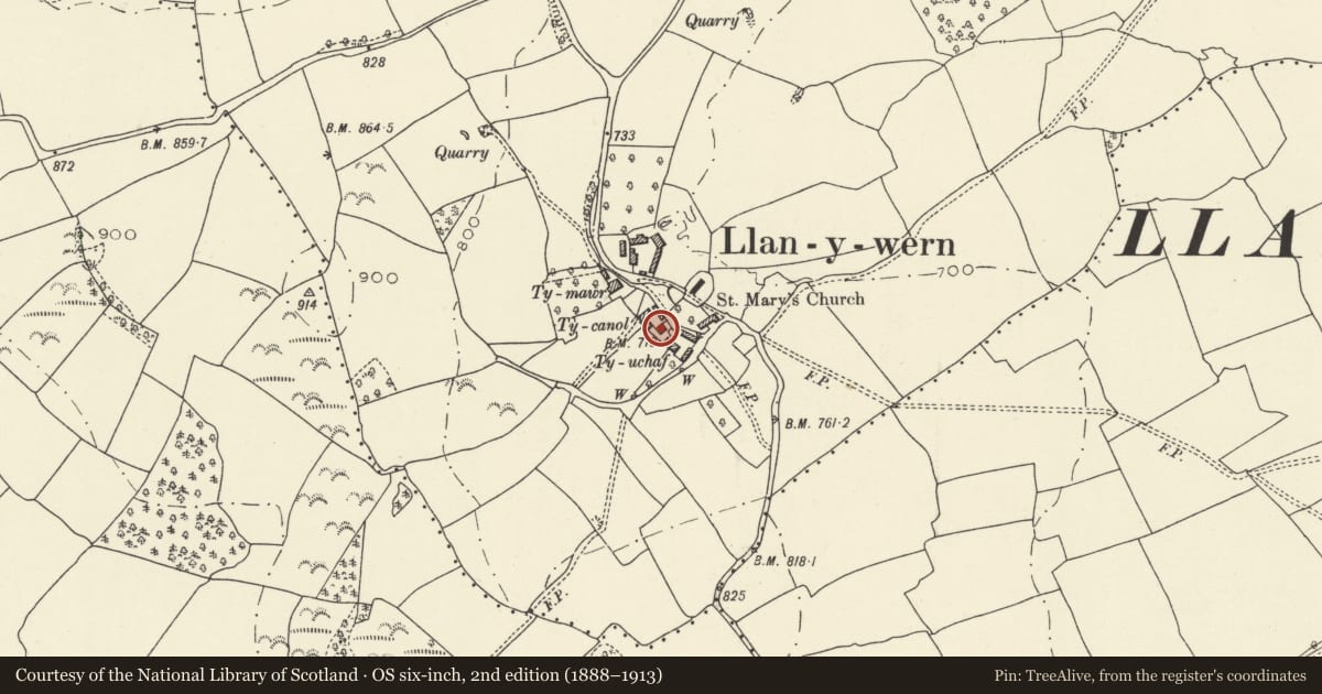
Slide toward Today to fade the historical sheet and see the modern map underneath.
David Rumsey Map Collection, Stanford LibrariesDavid Rumsey Map Collection, Stanford LibrariesDavid Rumsey Map Collection, Stanford LibrariesDavid Rumsey Map Collection, Stanford LibrariesDavid Rumsey Map Collection, Stanford Libraries
5 historical maps cover this location, the earliest the 1608 map "(13) Cambriae Typus." (David Rumsey Map Collection, Stanford Libraries).
Historical maps covering this location
- 1608 · (13) Cambriae Typus. (David Rumsey Map Collection, Stanford Libraries)
- 1636 · Cornubia : Devonia, Somersetus, Dorcestria, Wiltonia, Glocestria ... (David Rumsey Map Collection, Stanford Libraries)
- 1856 · 42. Brecon. (David Rumsey Map Collection, Stanford Libraries)
- 1896 · 214 Talgarth (Hills) (David Rumsey Map Collection, Stanford Libraries)
- 1901 · Sheet 14. (David Rumsey Map Collection, Stanford Libraries)
Cadw's description
Location
In the centre of Llan-y-Wern hamlet between the farmsteads of Ty Mawr and Ty Draw, W of the church.
History
Datestone 1850
Exterior
Farmhouse of stone rubble rendered to front, painted to side and rear, with Welsh slate roof, overhanging eaves, end ridge and rear lateral stacks. Two storeys to symmetrical front, catslide roof extends over lower 2 storey outshut to rear; 3 window range of smallpane 6-part cambered arched casements; similar to ground floor either side of central front door with matching arch. To rear a central cambered arched doorway flanked by two cambered arched windows, one multipane; similar square headed multipane windows to first floor. Main rear entrance to house is over a stone stile from lane; front with contemporary iron-railed forecourt faces farmyard.
Interior
Not accessible (August 1997).
Reason for designation
Included as an apparently quite unaltered mid C19 farmhouse.
Group value with other listed buildings within this historic settlement.
Nearby in the register
- Granary range at Ty CanolAgriculture and Subsistenceunder 1 mi
- Barn range at Ty CanolAgriculture and Subsistenceunder 1 mi
- Church of St MaryReligious, Ritual and Funeraryunder 1 mi
- Ty Mawr FarmhouseDomesticunder 1 mi
Other entries of the same register within about three miles of this one, by straight line.