Cof Cymru: National Historic Assets of Wales · Wales
Hawthorn Cottage
Halkyn, Flintshire, Wales
A Grade II listed building in Berth Ddu, Holywell, Halkyn, Flintshire, designated on 20 August 1998.
The record
- Designation
- Listed building, Grade II
- Broad class
- Domestic
- Date of designation
- 20 August 1998
- Locality
- Berth Ddu
- Town
- Holywell
- Community
- Halkyn
- Unitary authority
- Flintshire
- Country
- Wales
- Coordinates
- 53.21501, -3.18547
- Cadw reference
- 20279
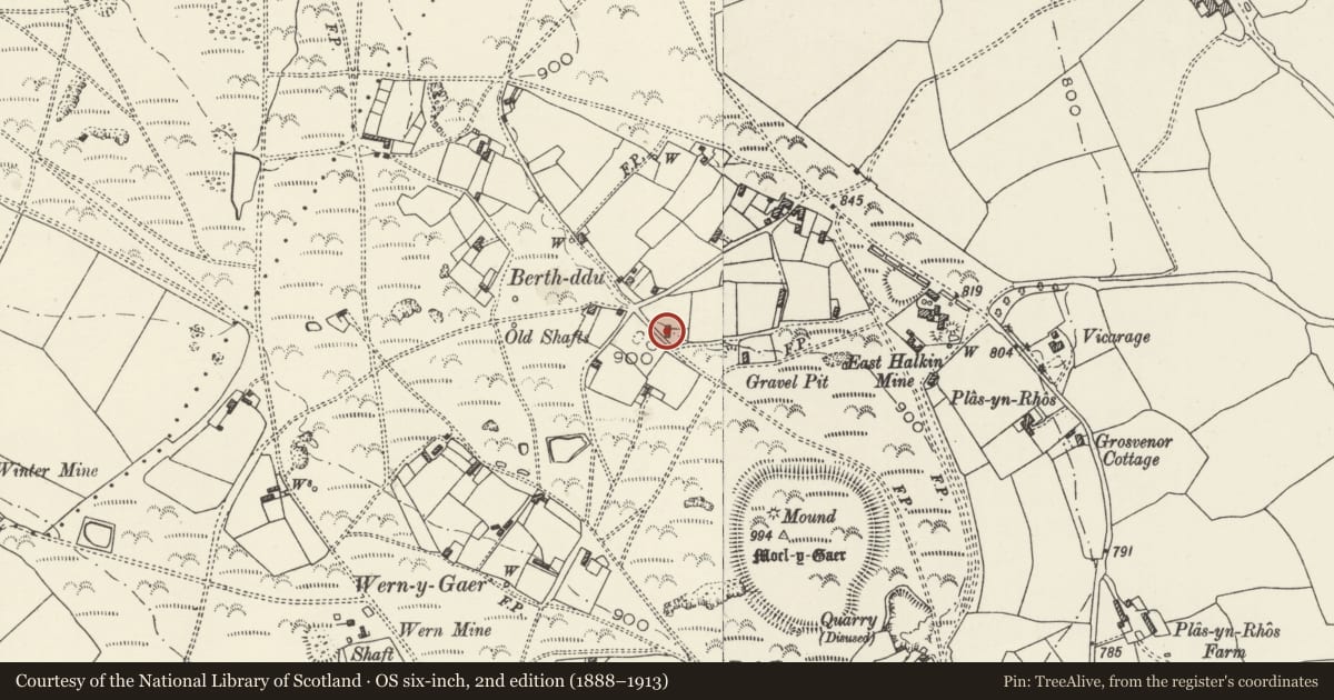
Slide toward Today to fade the historical sheet and see the modern map underneath.
David Rumsey Map Collection, Stanford LibrariesDavid Rumsey Map Collection, Stanford LibrariesDavid Rumsey Map Collection, Stanford LibrariesDavid Rumsey Map Collection, Stanford LibrariesLlyfrgell Genedlaethol Cymru – The National Library of Wales
5 historical maps cover this location, the earliest the 1795 map "To Sir Watkin Williams-Wynn Bart ... the map of the six counties of North Wales is most humbly inscribed by his obedient humble servant" (Llyfrgell Genedlaethol Cymru – The National Library of Wales).
Historical maps covering this location
- 1795 · To Sir Watkin Williams-Wynn Bart ... the map of the six counties of North Wales is most… (Llyfrgell Genedlaethol Cymru – The National Library of Wales)
- 1883 · Watershed map England, Wales 3. (David Rumsey Map Collection, Stanford Libraries)
- 1898 · 108 Flint (Hills) (David Rumsey Map Collection, Stanford Libraries)
- 1898 · 108 Flint (Outline) (David Rumsey Map Collection, Stanford Libraries)
- 1901 · Sheet 9 and 10. (David Rumsey Map Collection, Stanford Libraries)
Cadw's description
Location
Between Halkyn and Rhosesmor, reached via lane opposite Ysgol Rhos Helyg. Hawthorn Cottage is about 300m WSW of the school, S of a junction of lanes, and NW of Moel y Gaer.
History
A mid C19 cottage first shown on the 1870 Ordnance Survey, with later extensions to ends.
Exterior
A single-storey cottage of rendered walls and slate roof. Lower extensions at each end are in matching materials. The central, original section has prominent end stacks in exposed stone. The doorway is offset L of centre and has a boarded door in a large modern porch. The window to L has 9-pane fixed glazing, while to the R is a horizontal-sliding sash window. The extension to L has 2 windows, 4-pane fixed glazing to L, and 3-light casement to R. The extension to R has a modern casement window.
Reason for designation
Listed as a rare well-preserved C19 single-storey cottage, a type once common in the district and characteristic of cottages built on the common land.
Nearby in the register
- Ysgol Rhos HelygEducationunder 1 mi
- Moel y Gaer CampHillfortunder 1 mi
- The Old VicarageDomesticunder 1 mi
- Lime KilnIndustrialunder 1 mi
Other entries of the same register within about three miles of this one, by straight line.