Cof Cymru: National Historic Assets of Wales · Wales
Wall bounding driveway to the Stables and continuing the stable yard screen
Chirk, Wrexham, Wales
A Grade II listed building in Chirk Castle, Wrexham, Chirk, designated on 29 July 1998.
The record
- Designation
- Listed building, Grade II
- Broad class
- Gardens, Parks and Urban Spaces
- Date of designation
- 29 July 1998
- Locality
- Chirk Castle
- Town
- Wrexham
- Community
- Chirk
- Unitary authority
- Wrexham
- Country
- Wales
- Coordinates
- 52.93475, -3.09038
- Cadw reference
- 20266
Slide toward Today to fade the historical sheet and see the modern map underneath.
David Rumsey Map Collection, Stanford LibrariesDavid Rumsey Map Collection, Stanford LibrariesDavid Rumsey Map Collection, Stanford LibrariesLlyfrgell Genedlaethol Cymru – The National Library of WalesDavid Rumsey Map Collection, Stanford Libraries
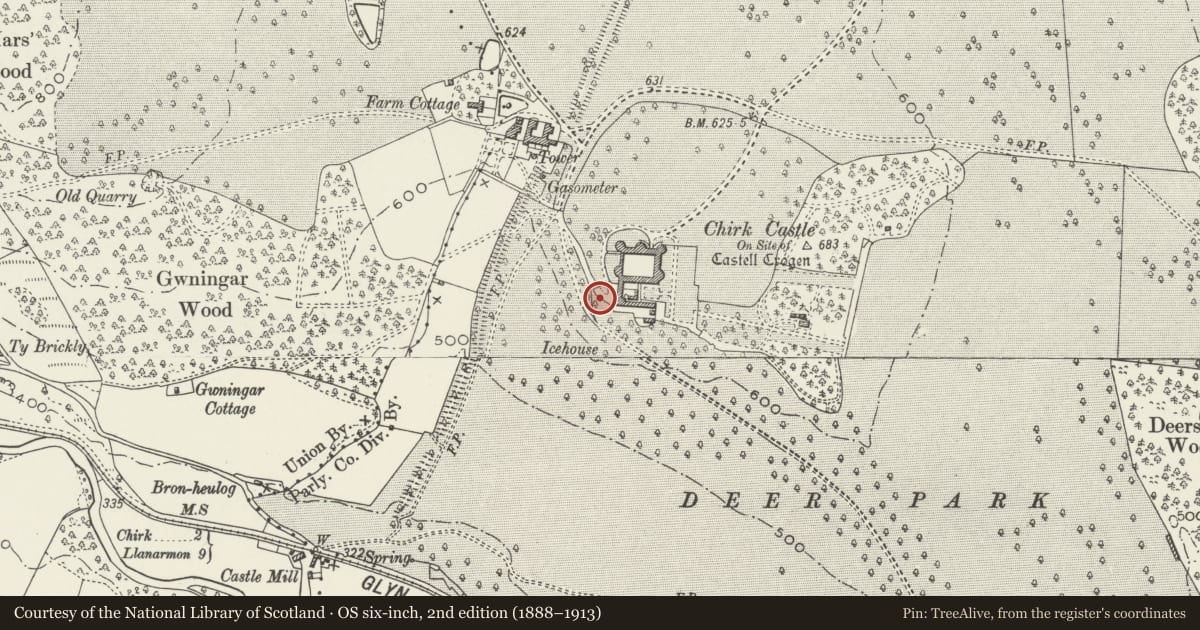
5 historical maps cover this location, the earliest the 1608 map "(13) Cambriae Typus." (David Rumsey Map Collection, Stanford Libraries).
Historical maps covering this location
- 1608 · (13) Cambriae Typus. (David Rumsey Map Collection, Stanford Libraries)
- 1795 · To Sir Watkin Williams-Wynn Bart ... the map of the six counties of North Wales is most… (Llyfrgell Genedlaethol Cymru – The National Library of Wales)
- 1883 · Watershed map England, Wales 3. (David Rumsey Map Collection, Stanford Libraries)
- 1898 · 121 Wrexham (Hills) (David Rumsey Map Collection, Stanford Libraries)
- 1901 · Sheet 9 and 10. (David Rumsey Map Collection, Stanford Libraries)
Cadw's description
Location
The driveway from Deepark Lodge drive climbs up to the stables. The wall defines the road on the SW side.
History
The wall was probably built in the mid C19 contemporary with E W Pugin's screen wall, and outlining the circulation to the SW corner of the castle originally laid out by William Emes in the 1760s.
Exterior
The wall is approximately 800m long and 1.5m high, built of uncoursed rubble stonework with a triangular ashlar coping. At the top it adjoins the end of the screen wall to the stable yard, and, at the bottom of the steep driveway, the wall terminates in a square pier with three offsetting ashlar copings forming a pyramid.
Reason for designation
Included as a significant element in the ensemble of buildings at Chirk Castle, and an essential part of the remodelling of the stable group in the Gothic idiom.
Nearby in the register
- Stable RangesDomesticunder 1 mi
- Wall on the NE side of the driveway to the StablesGardens, Parks and Urban Spacesunder 1 mi
- Screen Wall and Towers defining the S Stable Yard on the S sideDomesticunder 1 mi
- DovecoteAgriculture and Subsistenceunder 1 mi
Other entries of the same register within about three miles of this one, by straight line.