Cof Cymru: National Historic Assets of Wales · Wales
Chirk Surgery
Chirk, Wrexham, Wales
A Grade II listed building in Chirk, Wrexham, designated on 29 July 1998.
The record
- Designation
- Listed building, Grade II
- Broad class
- Health and Welfare
- Date of designation
- 29 July 1998
- Locality
- Chirk
- Town
- Wrexham
- Community
- Chirk
- Unitary authority
- Wrexham
- Country
- Wales
- Coordinates
- 52.93123, -3.05661
- Cadw reference
- 20256
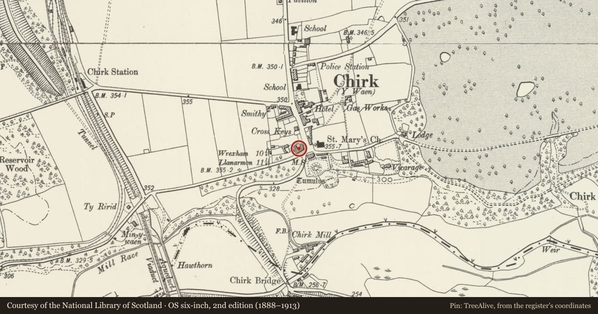
Slide toward Today to fade the historical sheet and see the modern map underneath.
David Rumsey Map Collection, Stanford LibrariesDavid Rumsey Map Collection, Stanford LibrariesDavid Rumsey Map Collection, Stanford LibrariesLlyfrgell Genedlaethol Cymru – The National Library of WalesDavid Rumsey Map Collection, Stanford Libraries
5 historical maps cover this location, the earliest the 1608 map "(13) Cambriae Typus." (David Rumsey Map Collection, Stanford Libraries).
Historical maps covering this location
- 1608 · (13) Cambriae Typus. (David Rumsey Map Collection, Stanford Libraries)
- 1795 · To Sir Watkin Williams-Wynn Bart ... the map of the six counties of North Wales is most… (Llyfrgell Genedlaethol Cymru – The National Library of Wales)
- 1883 · Watershed map England, Wales 3. (David Rumsey Map Collection, Stanford Libraries)
- 1898 · 121 Wrexham (Hills) (David Rumsey Map Collection, Stanford Libraries)
- 1901 · Sheet 9 and 10. (David Rumsey Map Collection, Stanford Libraries)
Cadw's description
Location
The building is one of a row of at the start of Castle Road.
History
The building is one of a row of 4 urban terrace houses of late C17 or C18 origin, all refaced in brick in the early-mid C19.
Exterior
Brick frontage on a stone and timber framed building, slate roof. Two storeys, 4 window bays. Modern glazed door in the second bay from the E, set under a C19 gabled timber framed porch hood on brackets. A secondary modern door is set in the former carriage arch in the 4th bay. Stone sills and plinth continuous with the adjoining properties. Timber small-paned casement windows in openings with segmental heads. Brick stack between bays 3 and 4. The rear, largely covered with added outbuildings, is of stone, with the upper level timber framed.
Interior
The interior has been extensively modernised.
Reason for designation
Included as one of a row forming a prominent urban group at the centre of Chirk.
Nearby in the register
- 1 Castle RoadDomesticunder 1 mi
- Bryn EglwysDomesticunder 1 mi
- MilestoneTransportunder 1 mi
- The Mount, with front garden railings and gateDomesticunder 1 mi
Other entries of the same register within about three miles of this one, by straight line.