Cof Cymru: National Historic Assets of Wales · Wales
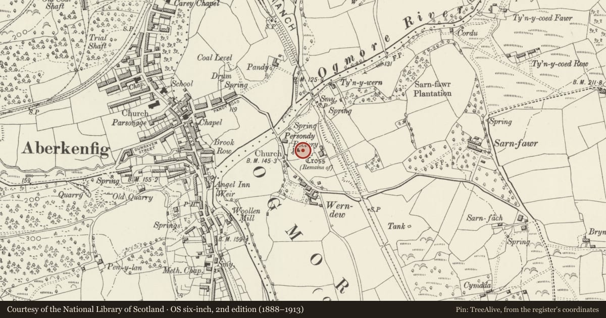
Churchyard cross socket in Llansantffraid churchyard
St. Bride's Minor, Bridgend, Wales
A Grade II listed building in Sarn, St. Bride's Minor, Bridgend, designated on 22 July 1998.
The record
- Designation
- Listed building, Grade II
- Broad class
- Religious, Ritual and Funerary
- Date of designation
- 22 July 1998
- Locality
- Sarn
- Community
- St. Bride's Minor
- Unitary authority
- Bridgend
- Country
- Wales
- Coordinates
- 51.53941, -3.59178
- Cadw reference
- 20181
Slide toward Today to fade the historical sheet and see the modern map underneath.
David Rumsey Map Collection, Stanford LibrariesDavid Rumsey Map Collection, Stanford LibrariesDavid Rumsey Map Collection, Stanford LibrariesDavid Rumsey Map Collection, Stanford LibrariesDavid Rumsey Map Collection, Stanford Libraries
5 historical maps cover this location, the earliest the 1636 map "Cornubia : Devonia, Somersetus, Dorcestria, Wiltonia, Glocestria ..." (David Rumsey Map Collection, Stanford Libraries).
Historical maps covering this location
- 1636 · Cornubia : Devonia, Somersetus, Dorcestria, Wiltonia, Glocestria ... (David Rumsey Map Collection, Stanford Libraries)
- 1637 · The fourth table of England. Cornub. Devonia, Somerset etc. (David Rumsey Map Collection, Stanford Libraries)
- 1865 · England and Wales. England No. 6. (David Rumsey Map Collection, Stanford Libraries)
- 1895 · Sheet 11. Ordnance Survey of England and Wales. (David Rumsey Map Collection, Stanford Libraries)
- 1907 · 248 Pontypridd (Hills) (David Rumsey Map Collection, Stanford Libraries)
Cadw's description
Location
E of the church adjacent to the EW path through the churchyard.
History
Medieval cross socket unlikely to be in its original position as nearby ground has clearly been lowered and the socket is without the usual high stepped base, though traces of this latter may still exist in the churchyard. Churchyard crosses had a number of functions including acting as the focus for liturgical processions, designating the sanctity of the churchyard before individual churchyard monuments proliferated after the Reformation, and as a venue for itinerant preachers.
Exterior
A roughly square socket stone broached to hold an octagonal shaft a small portion of which is set within the socket.
Reason for designation
Included for its historic interest and for group value with the churchyard monuments and the church.
Nearby in the register
- Church of St Ffraid aka St Bride, LlansantffraidReligious, Ritual and Funeraryunder 1 mi
- Monument to Morgan Morgan in Llansantffraid churchyardCommemorativeunder 1 mi
- Williams monument and railings in Llansantffraid churchyardCommemorativeunder 1 mi
- Bowen/Roberts Monuments in Llansantfrraid churchyardCommemorativeunder 1 mi
Other entries of the same register within about three miles of this one, by straight line.