Cof Cymru: National Historic Assets of Wales · Wales
Carthouse at Bronheulog
Llanfair Talhaiarn, Conwy, Wales
A Grade II listed building in Bronheulog, Llanfair Talhaiarn, Conwy, designated on 22 July 1998.
The record
- Designation
- Listed building, Grade II
- Broad class
- Agriculture and Subsistence
- Date of designation
- 22 July 1998
- Locality
- Bronheulog
- Community
- Llanfair Talhaiarn
- Unitary authority
- Conwy
- Country
- Wales
- Coordinates
- 53.22838, -3.60126
- Cadw reference
- 20161
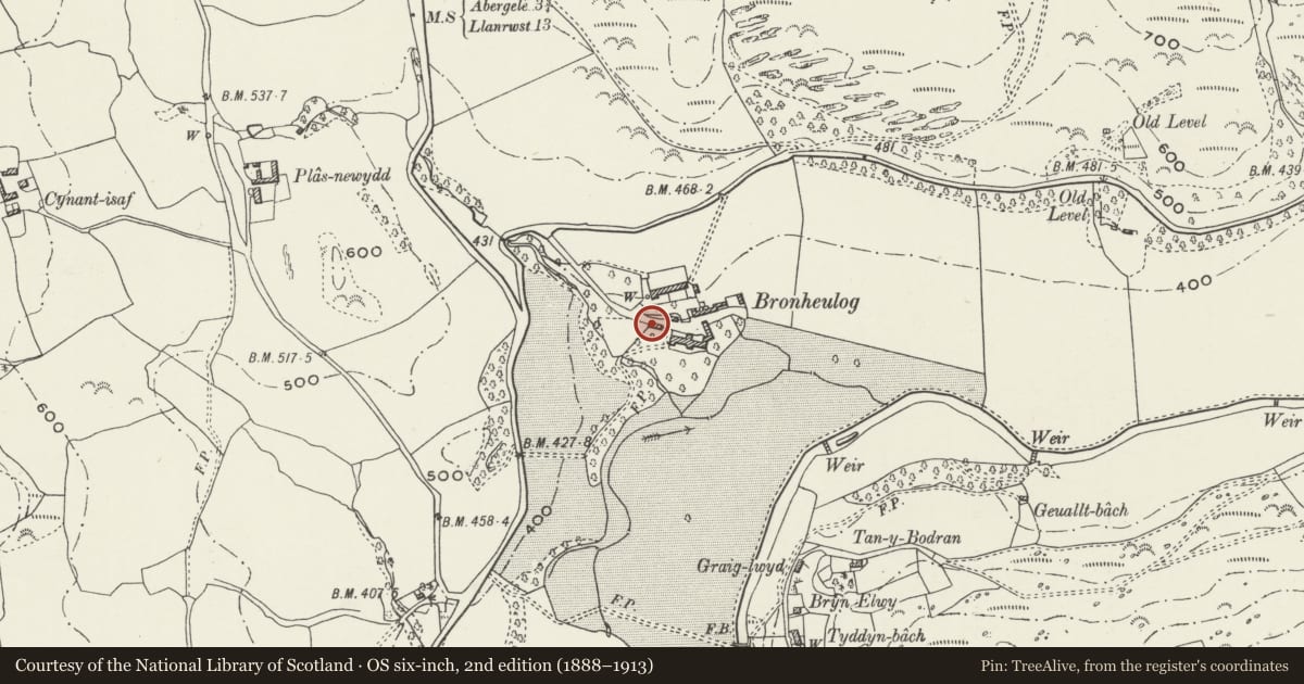
Slide toward Today to fade the historical sheet and see the modern map underneath.
David Rumsey Map Collection, Stanford LibrariesNational Library of ScotlandDavid Rumsey Map Collection, Stanford LibrariesLlyfrgell Genedlaethol Cymru – The National Library of WalesDavid Rumsey Map Collection, Stanford Libraries
5 historical maps cover this location, the earliest the 1795 map "To Sir Watkin Williams-Wynn Bart ... the map of the six counties of North Wales is most humbly inscribed by his obedient humble servant" (Llyfrgell Genedlaethol Cymru – The National Library of Wales).
Historical maps covering this location
- 1795 · To Sir Watkin Williams-Wynn Bart ... the map of the six counties of North Wales is most… (Llyfrgell Genedlaethol Cymru – The National Library of Wales)
- 1830 · V.3:11-15:XV. Britisches Reich. A. Kon: England. b. Frstenthum Wales: Shire: 37-40 (David Rumsey Map Collection, Stanford Libraries)
- 1883 · Watershed map England, Wales 3. (David Rumsey Map Collection, Stanford Libraries)
- 1901 · Sheet 9 and 10. (David Rumsey Map Collection, Stanford Libraries)
- 1963 · Map No. 35 - Local Government Commission for Wales : [Definitive maps showing proposed… (National Library of Scotland)
Cadw's description
Location
Located diagonally opposite the Pigeon-house and Stable Block at the approach to the lower farmyard.
History
Mid or third-quarter C19.
Exterior
Four-bay rectangular carthouse of rubble construction with slate roof. Three wide cart entrances with cambered brick heads and plain dividing rubble piers; the final, right-hand bay has a flat wooden lintel and is open to the eaves. A small rubble lean-to adjoins the L gable. This has a modern boarded door to the L and a boarded loading bay with exposed lintel to the front. The right-hand section to the rear has been rebuilt in modern breeze block; a wooden and corrugated iron lean-to adjoins the rear to the L.
Interior
Four-bay interior with tie-beam and raking strut trusses.
Reason for designation
Included for group value with other listed items at Bronheulog.
Nearby in the register
- Pigeon-house and Stable Block at BronheulogAgriculture and Subsistenceunder 1 mi
- BronheulogDomesticunder 1 mi
- Plas NewyddDomesticunder 1 mi
- Former Brewhouse at Ty'n-y-FfrithAgriculture and Subsistenceunder 1 mi
Other entries of the same register within about three miles of this one, by straight line.