Cof Cymru: National Historic Assets of Wales · Wales
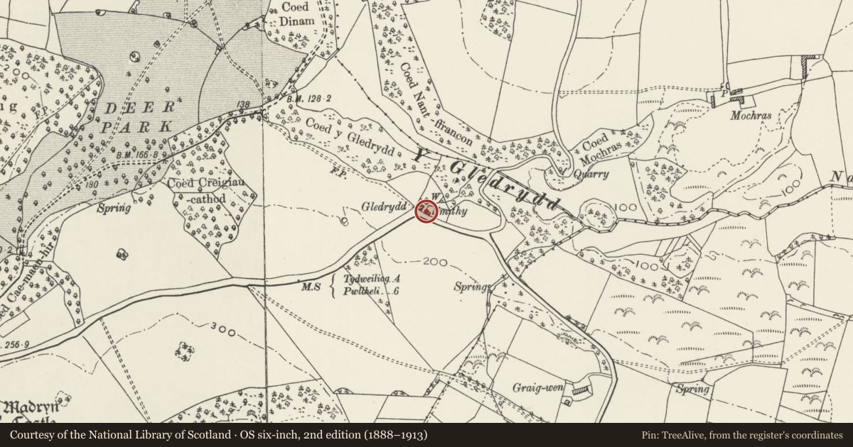
Efail Gledrydd
Buan, Gwynedd, Wales
A Grade II listed building in Madryn, Pwllheli, Buan, Gwynedd, designated on 15 July 1998.
The record
- Designation
- Listed building, Grade II
- Broad class
- Domestic
- Date of designation
- 15 July 1998
- Locality
- Madryn
- Town
- Pwllheli
- Community
- Buan
- Unitary authority
- Gwynedd
- Country
- Wales
- Coordinates
- 52.89869, -4.53650
- Cadw reference
- 20129
Slide toward Today to fade the historical sheet and see the modern map underneath.
David Rumsey Map Collection, Stanford LibrariesDavid Rumsey Map Collection, Stanford LibrariesDavid Rumsey Map Collection, Stanford LibrariesDavid Rumsey Map Collection, Stanford LibrariesDavid Rumsey Map Collection, Stanford Libraries
5 historical maps cover this location, the earliest the 1608 map "(13) Cambriae Typus." (David Rumsey Map Collection, Stanford Libraries).
Historical maps covering this location
- 1608 · (13) Cambriae Typus. (David Rumsey Map Collection, Stanford Libraries)
- 1830 · V.3:11-15:XV. Britisches Reich. A. Kon: England. b. Frstenthum Wales: Shire: 37-40 (David Rumsey Map Collection, Stanford Libraries)
- 1883 · Watershed map England, Wales 3. (David Rumsey Map Collection, Stanford Libraries)
- 1899 · 134 Pwllheli (Hills) (David Rumsey Map Collection, Stanford Libraries)
- 1901 · Sheet 9 and 10. (David Rumsey Map Collection, Stanford Libraries)
Cadw's description
Location
Situated downhill from Efail Gledrydd forge, some 2 km NW of Garn Fadryn. 1 km NW Madryn Castle Gatehouse.
History
Former blacksmith's house, possibly C18 but with some later alterations. Smithy nearby was worked until closure in 1952, by Thomas Jones, and previously by his father Richard Jones, and grandfather Thomas Jones. Marked on OS Drawings of 1816-19.
Exterior
Small two-storey traditional house, sited down slope, with rear outshut. Pebble-dashed rubble-stone with purple slates to roof, and pebble-dashed end-chimneys, probably rebuilt. SE front has vernacular proportions offset to right. Double fronted with small windows each floor each side, C20 glazing and C20 half-glazed door to right of centre. Left end wall has boarded door in rear outshut with small single-light casement to left and small two-light sash over.
Reason for designation
Included as part of a group with the adjacent Blacksmith's shop, the house retains vernacular character notwithstanding alteration to detail.
Nearby in the register
- Efail Gledrydd ForgeIndustrialunder 1 mi
- Nant y Gledrydd Standing StoneStanding Stoneunder 1 mi
- Meillionen FarmhouseDomesticunder 1 mi
- Madryn Castle GatehouseDomesticunder 1 mi
Other entries of the same register within about three miles of this one, by straight line.