Cof Cymru: National Historic Assets of Wales · Wales
Sundial in churchyard of St Elian's Church
Betws Yn Rhos, Conwy, Wales
A Grade II listed building in Llanelian-yn-Rhos, Abergele, Betws Yn Rhos, Conwy, designated on 2 July 1998.
The record
- Designation
- Listed building, Grade II
- Broad class
- Gardens, Parks and Urban Spaces
- Date of designation
- 2 July 1998
- Locality
- Llanelian-yn-Rhos
- Town
- Abergele
- Community
- Betws Yn Rhos
- Unitary authority
- Conwy
- Country
- Wales
- Coordinates
- 53.27256, -3.70532
- Cadw reference
- 20085
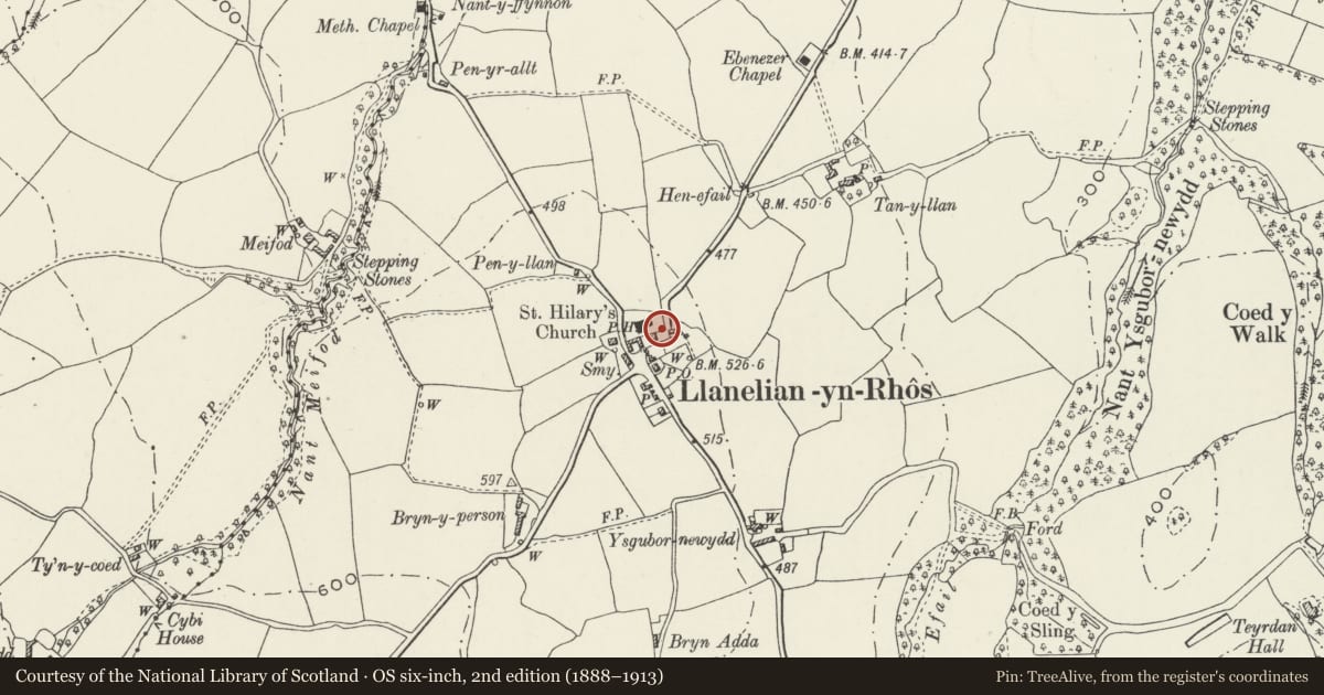
Slide toward Today to fade the historical sheet and see the modern map underneath.
David Rumsey Map Collection, Stanford LibrariesDavid Rumsey Map Collection, Stanford LibrariesDavid Rumsey Map Collection, Stanford LibrariesLlyfrgell Genedlaethol Cymru – The National Library of WalesDavid Rumsey Map Collection, Stanford Libraries
5 historical maps cover this location, the earliest the 1795 map "To Sir Watkin Williams-Wynn Bart ... the map of the six counties of North Wales is most humbly inscribed by his obedient humble servant" (Llyfrgell Genedlaethol Cymru – The National Library of Wales).
Historical maps covering this location
- 1795 · To Sir Watkin Williams-Wynn Bart ... the map of the six counties of North Wales is most… (Llyfrgell Genedlaethol Cymru – The National Library of Wales)
- 1830 · V.3:11-15:XV. Britisches Reich. A. Kon: England. b. Frstenthum Wales: Shire: 37-40 (David Rumsey Map Collection, Stanford Libraries)
- 1883 · Watershed map England, Wales 3. (David Rumsey Map Collection, Stanford Libraries)
- 1898 · 95 Rhyl (Hills) (David Rumsey Map Collection, Stanford Libraries)
- 1901 · Sheet 9 and 10. (David Rumsey Map Collection, Stanford Libraries)
Cadw's description
Location
Located in the SE corner of the raised churchyard.
History
Late C18 or early C19 sundial with base constructed out of a re-used limestone shaft, possibly part of a former medieval village cross.
Exterior
Chamfered, tapering limestone shaft with square sandstone top; set into this is a square brass sundial with decorative gnomon. Square 2-stage rough limestone base.
Reason for designation
Included for group value with other listed items at St Elian's Church.
Nearby in the register
- Holland Chest Tomb, including adjacent Tombstone to N, in churchyard of St Elian's ChurchReligious, Ritual and Funeraryunder 1 mi
- Railed Tomb of Holland Family in churchyard of St Elian's ChurchReligious, Ritual and Funeraryunder 1 mi
- Railed Tomb of Edwards Family in churchyard of St Elian's ChurchReligious, Ritual and Funeraryunder 1 mi
- Parish Church of St ElianReligious, Ritual and Funeraryunder 1 mi
Other entries of the same register within about three miles of this one, by straight line.