Cof Cymru: National Historic Assets of Wales · Wales
Towyn Lodge
Trearddur, Isle of Anglesey, Wales
A Grade II listed building in Trearddur, Trearddur Bay, Isle of Anglesey, designated on 30 June 1998.
The record
- Designation
- Listed building, Grade II
- Broad class
- Domestic
- Date of designation
- 30 June 1998
- Locality
- Trearddur
- Town
- Trearddur Bay
- Community
- Trearddur
- Unitary authority
- Isle of Anglesey
- Country
- Wales
- Coordinates
- 53.27425, -4.61863
- Cadw reference
- 20070
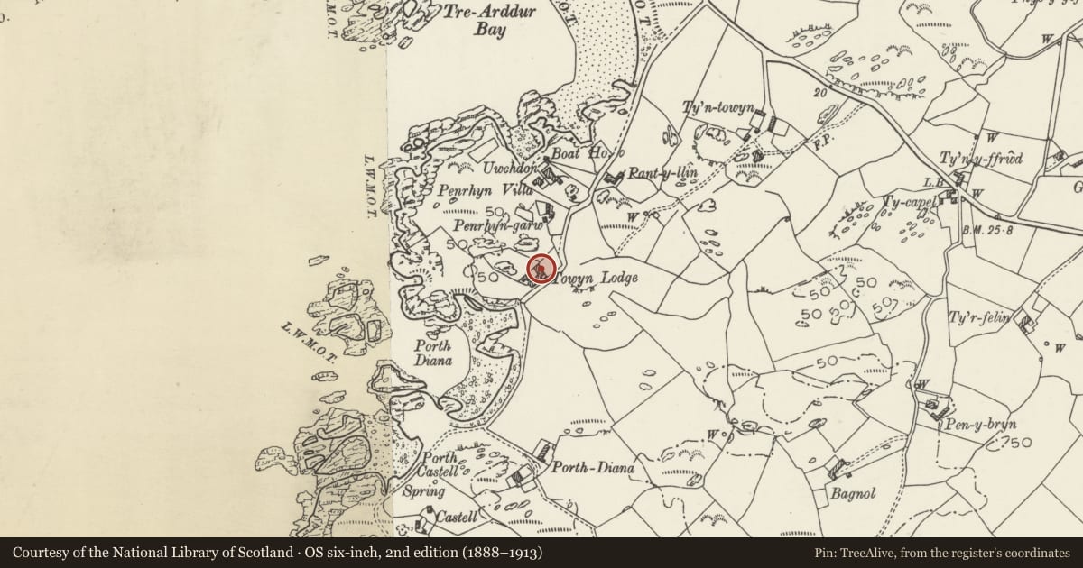
Slide toward Today to fade the historical sheet and see the modern map underneath.
David Rumsey Map Collection, Stanford LibrariesDavid Rumsey Map Collection, Stanford LibrariesDavid Rumsey Map Collection, Stanford LibrariesDavid Rumsey Map Collection, Stanford LibrariesDavid Rumsey Map Collection, Stanford Libraries
5 historical maps cover this location, the earliest the 1799 map "Ireland." (David Rumsey Map Collection, Stanford Libraries).
Historical maps covering this location
- 1799 · Ireland. (David Rumsey Map Collection, Stanford Libraries)
- 1883 · Watershed map England, Wales 3. (David Rumsey Map Collection, Stanford Libraries)
- 1899 · 93 Holyhead (Hills) (David Rumsey Map Collection, Stanford Libraries)
- 1901 · Sheet 9 and 10. (David Rumsey Map Collection, Stanford Libraries)
- 1919 · Sheet 41. Anglesey. (David Rumsey Map Collection, Stanford Libraries)
Cadw's description
Location
Set back from the NW side of Ravenspoint road, at the junction with Penrhyn Garw and c500m SW of the Church of St. Ffraid in Trearddur Bay.
History
Early C19, built by Bates, a stonemason from Holyhead; thought to date from 1820's and locally reputed to have been the residence of Thomas Telford whilst work was carried out on the northern part of the route of the A5 across Anglesey. Built as one residence, now converted into 4 flats.
Exterior
A rectangular 2-storey, 4-window range; roughcast rendered walls with a hipped slate roof and rectangular rendered axial and end wall stacks. Main entrance elevation has entrance offset to left end with a timber porch of slender coupled chamfered columns supporting a moulded cornice; doorway in architrave with reeded pilasters, flanked by recessed moulded panels. Windows are slightly recessed hornless sash windows, 20-pane to ground floor, 16-pane to first floor; those to the rear are 6 and 8-pane casements. The house is abutted on the left side by a castellated rubble wall which has a square-headed gateway at the right and a modern gateway to left.
Interior
The interior layout has been extensively altered during the conversion to 4 dwellings and the original staircase removed. Said by the owners, to still retain original doors and covings and some fireplaces.
Reason for designation
Listed as a fine early C19 house retaining much of the original character externally, notwithstanding alterations to the interior.
Nearby in the register
- AvilionDomesticunder 1 mi
- Porth y CastellDomesticunder 1 mi
- Pillbox in grounds of Trearddur HouseDefenceunder 1 mi
- Pillbox adjacent to Trearddur Bay HotelDefenceunder 1 mi
Other entries of the same register within about three miles of this one, by straight line.