Cof Cymru: National Historic Assets of Wales · Wales
Walls to Ty Pellaf and Rhedynog Goch
Aberdaron, Gwynedd, Wales
A Grade II listed building in Yr Enlli / Bardsey Island, Aberdaron, Gwynedd, designated on 26 June 1998.
The record
- Designation
- Listed building, Grade II
- Broad class
- Domestic
- Date of designation
- 26 June 1998
- Locality
- Yr Enlli / Bardsey Island
- Community
- Aberdaron
- Unitary authority
- Gwynedd
- Country
- Wales
- Coordinates
- 52.75701, -4.78793
- Cadw reference
- 20066
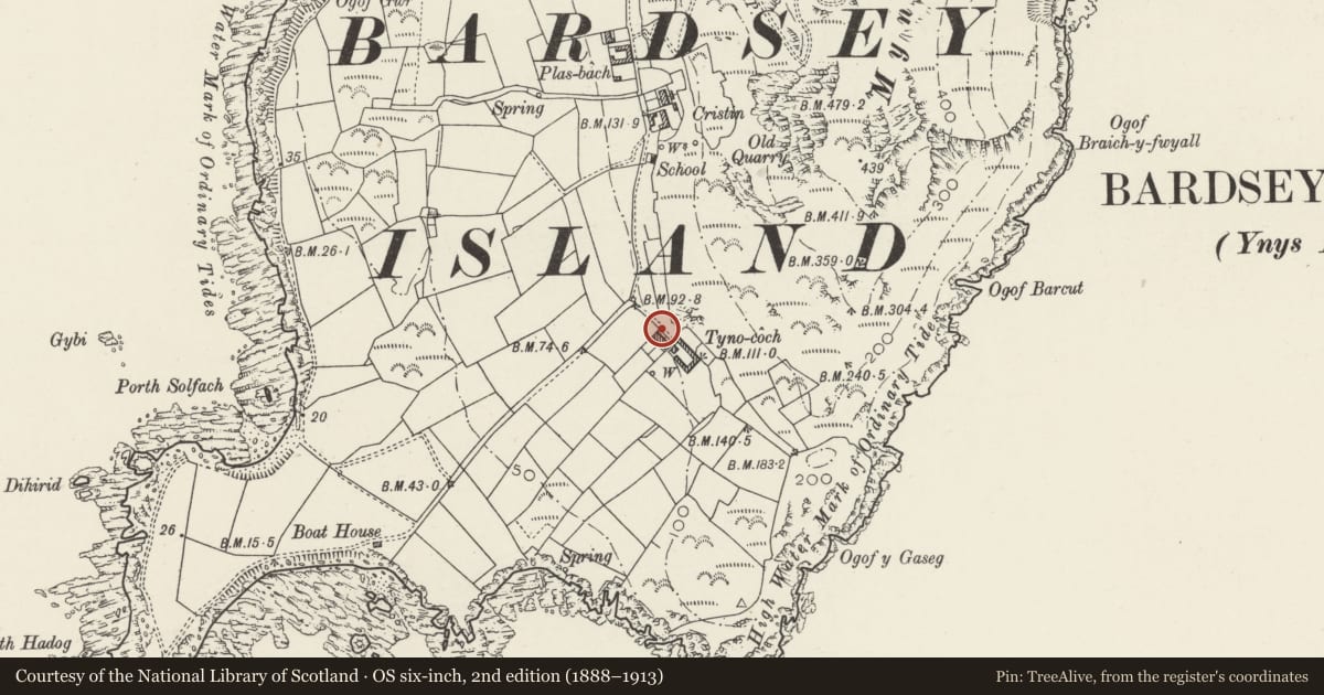
Slide toward Today to fade the historical sheet and see the modern map underneath.
David Rumsey Map Collection, Stanford LibrariesDavid Rumsey Map Collection, Stanford LibrariesDavid Rumsey Map Collection, Stanford LibrariesDavid Rumsey Map Collection, Stanford LibrariesDavid Rumsey Map Collection, Stanford Libraries
5 historical maps cover this location, the earliest the 1608 map "(13) Cambriae Typus." (David Rumsey Map Collection, Stanford Libraries).
Historical maps covering this location
- 1608 · (13) Cambriae Typus. (David Rumsey Map Collection, Stanford Libraries)
- 1637 · Particular description of Wales. Cambria seu Wallia (David Rumsey Map Collection, Stanford Libraries)
- 1799 · Ireland. (David Rumsey Map Collection, Stanford Libraries)
- 1883 · Watershed map England, Wales 3. (David Rumsey Map Collection, Stanford Libraries)
- 1898 · 133 Bardsey Island (Hills) (David Rumsey Map Collection, Stanford Libraries)
Cadw's description
Location
Garden walls surrounding Ty Pellaf and Rhedynog Goch.
History
Garden walls in front of Ty Pellaf and Rhedynog Goch and walls to narrow rear yards with earth closets. Built with the pair of houses c1870-5 as part of the rebuilding of the island farms by the 3rd Lord Newborough.
Exterior
Garden walls, rubble stone with rough stone capping. Walls surround both houses in large rectangle with central dividing wall and cross-wall in front of houses. Rear wall is ramped down each side from outer corners to 2 gateways and has lean-to earth closets in corners with raised stone-faced beds each side for compost from closets. Sidewalls have gates to paths along front of houses and large vegetable gardens run downhill from front terrace with gates in cross-wall.
Reason for designation
Included for group value with Ty pellaf and Rhedynog Goch, part of a series of walled enclosures which is a distinctive feature of the island landscape.
Nearby in the register
- Ty Pellaf and Rhedynog GochDomesticunder 1 mi
- LimekilnAgriculture and Subsistenceunder 1 mi
- Walled Court to Rhedynog Goch and Ty PellafDomesticunder 1 mi
- The Old SchoolEducationunder 1 mi
Other entries of the same register within about three miles of this one, by straight line.