Cof Cymru: National Historic Assets of Wales · Wales
Cae-crin
Aberdaron, Gwynedd, Wales
A Grade II listed building in Uwchmynydd, Pwllheli, Aberdaron, Gwynedd, designated on 26 June 1998.
The record
- Designation
- Listed building, Grade II
- Broad class
- Domestic
- Date of designation
- 26 June 1998
- Locality
- Uwchmynydd
- Town
- Pwllheli
- Community
- Aberdaron
- Unitary authority
- Gwynedd
- Country
- Wales
- Coordinates
- 52.78912, -4.74796
- Cadw reference
- 20046
Slide toward Today to fade the historical sheet and see the modern map underneath.
David Rumsey Map Collection, Stanford LibrariesDavid Rumsey Map Collection, Stanford LibrariesDavid Rumsey Map Collection, Stanford LibrariesDavid Rumsey Map Collection, Stanford LibrariesDavid Rumsey Map Collection, Stanford Libraries
5 historical maps cover this location, the earliest the 1608 map "(13) Cambriae Typus." (David Rumsey Map Collection, Stanford Libraries).
Historical maps covering this location
- 1608 · (13) Cambriae Typus. (David Rumsey Map Collection, Stanford Libraries)
- 1637 · Particular description of Wales. Cambria seu Wallia (David Rumsey Map Collection, Stanford Libraries)
- 1799 · Ireland. (David Rumsey Map Collection, Stanford Libraries)
- 1883 · Watershed map England, Wales 3. (David Rumsey Map Collection, Stanford Libraries)
- 1898 · 133 Bardsey Island (Hills) (David Rumsey Map Collection, Stanford Libraries)
Cadw's description
Location
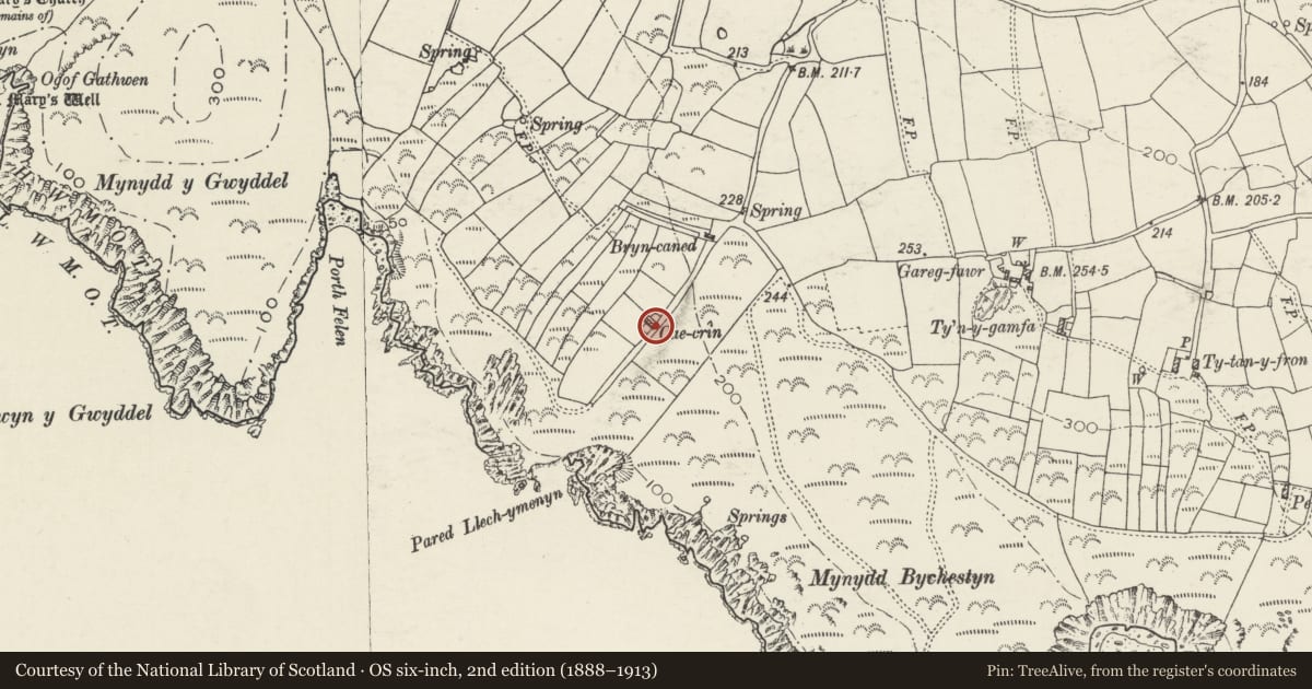
Situated some 1.7 km SSW of Capel Uwchmynydd, at end of lane and then down grassed track S of Bryn Caned.
History
Croglofft cottage, and attached farmbuilding forming a very small holding probably of the earlier C19, set on the headland overlooking Ynys Enlli. Not obviously marked on 1844 Tithe Map but a holding named Cae Crin is named in the schedule, owned by Daniel Roberts, occupied by John Evans, with 6 acres (2.4ha).
Exterior
Cottage, whitewashed rubble stone with grouted slate roof, coped gables and single squat square left end stack, whitewashed with dripstones and pyramid capping. Single-storey, part-lofted, double-fronted with facade offset to right. Two narrow 6-pane windows (panes of uneven size) flanking full-height ledged door. Outbuilding, probably former byre to left, C20 window breaking eaves. Rear has one small window left and added C20 lean-to to right continued behind byre.
Reason for designation
Included as good example of small croglofft cottage holding of the region, in exceptional landscape setting.
Nearby in the register
- Bryn CanedDomesticunder 1 mi
- MilestoneTransportunder 1 mi
- St Mary's ChurchChurchunder 1 mi
- CwrtDomestic1 mi
Other entries of the same register within about three miles of this one, by straight line.