Cof Cymru: National Historic Assets of Wales · Wales
Milestone
Nefyn, Gwynedd, Wales
A Grade II listed building in Edern, Pwllheli, Nefyn, Gwynedd, designated on 18 June 1998.
The record
- Designation
- Listed building, Grade II
- Broad class
- Transport
- Date of designation
- 18 June 1998
- Locality
- Edern
- Town
- Pwllheli
- Community
- Nefyn
- Unitary authority
- Gwynedd
- Country
- Wales
- Coordinates
- 52.91878, -4.58474
- Cadw reference
- 19976
Slide toward Today to fade the historical sheet and see the modern map underneath.
David Rumsey Map Collection, Stanford LibrariesDavid Rumsey Map Collection, Stanford LibrariesDavid Rumsey Map Collection, Stanford LibrariesDavid Rumsey Map Collection, Stanford LibrariesDavid Rumsey Map Collection, Stanford Libraries
5 historical maps cover this location, the earliest the 1608 map "(13) Cambriae Typus." (David Rumsey Map Collection, Stanford Libraries).
Historical maps covering this location
- 1608 · (13) Cambriae Typus. (David Rumsey Map Collection, Stanford Libraries)
- 1830 · V.3:11-15:XV. Britisches Reich. A. Kon: England. b. Frstenthum Wales: Shire: 37-40 (David Rumsey Map Collection, Stanford Libraries)
- 1883 · Watershed map England, Wales 3. (David Rumsey Map Collection, Stanford Libraries)
- 1899 · 118 Nevin (Hills) (David Rumsey Map Collection, Stanford Libraries)
- 1901 · Sheet 9 and 10. (David Rumsey Map Collection, Stanford Libraries)
Cadw's description
Location
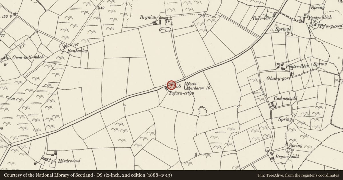
Situated on the N side of the B4417, approximately 1km SW of Edern Presbyterian Chapel.
History
Probably early C19 milestone, one of a series of primitive stones inscribed with initial letters on the Caernarfon to Aberdaron road.
Exterior
Milestone, rough stone approximately 60cm high and 40cm wide with inscription -
N 3
A 10
being the distances to Nefyn and Aberdaron.
Reason for designation
Included as one of the group of early milestones on the Llyn.
Nearby in the register
- Edern Presbyterian ChapelReligious, Ritual and Funeraryunder 1 mi
- Pen-y-brynDomesticunder 1 mi
- Glan AfonDomestic1 mi
- Factory CottageDomestic1 mi
Other entries of the same register within about three miles of this one, by straight line.