Cof Cymru: National Historic Assets of Wales · Wales
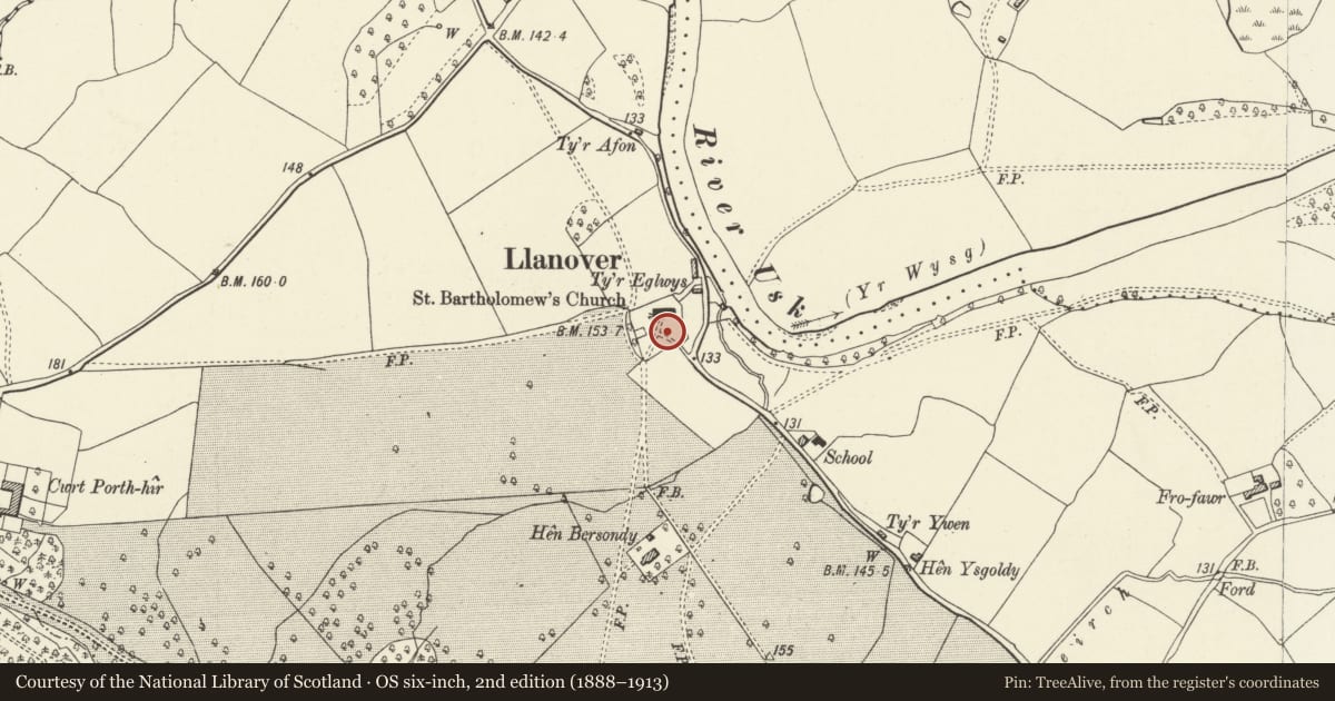
Cross in Churchyard of Church of St. Bartholomew
Goetre Fawr, Monmouthshire, Wales
A Grade II listed building in Llanover, Abergavenny, Goetre Fawr, Monmouthshire, designated on 9 January 1956.
The record
- Designation
- Listed building, Grade II
- Broad class
- Religious, Ritual and Funerary
- Date of designation
- 9 January 1956
- Locality
- Llanover
- Town
- Abergavenny
- Community
- Goetre Fawr
- Unitary authority
- Monmouthshire
- Country
- Wales
- Coordinates
- 51.77908, -2.99009
- Cadw reference
- 1993
Slide toward Today to fade the historical sheet and see the modern map underneath.
David Rumsey Map Collection, Stanford LibrariesDavid Rumsey Map Collection, Stanford LibrariesDavid Rumsey Map Collection, Stanford LibrariesDavid Rumsey Map Collection, Stanford LibrariesDavid Rumsey Map Collection, Stanford Libraries
5 historical maps cover this location, the earliest the 1636 map "Cornubia : Devonia, Somersetus, Dorcestria, Wiltonia, Glocestria ..." (David Rumsey Map Collection, Stanford Libraries).
Historical maps covering this location
- 1636 · Cornubia : Devonia, Somersetus, Dorcestria, Wiltonia, Glocestria ... (David Rumsey Map Collection, Stanford Libraries)
- 1895 · Sheet 11. Ordnance Survey of England and Wales. (David Rumsey Map Collection, Stanford Libraries)
- 1898 · 232 Abergavenny (Hills) (David Rumsey Map Collection, Stanford Libraries)
- 1898 · 232 Abergavenny (Outline) (David Rumsey Map Collection, Stanford Libraries)
- 1913 · Sheet 102. Newport. (David Rumsey Map Collection, Stanford Libraries)
Cadw's description
Location
On the south side of the church.
History
A late medieval, probably late C15, churchyard cross which remains unrestored in its incomplete state. This kind of appearance, so well preserved from the day it was deliberately damaged in the C16 or C17 is now a great rarity.
Exterior
Built of grey and pink sandstone blocks. Four tall square diminishing steps, large broached socket stone, spurred shaft, the cross-head is missing.
Reason for designation
Included for its special interest as a probably late medieval churchyard cross of good character which is unrestored and has group value with the adjoining church.
Scheduled Ancient Monument: MM307(MON).
Nearby in the register
- St. Bartholomew's Churchyard Cross, LlanoverCrossunder 1 mi
- Church of St. BartholomewReligious, Ritual and Funeraryunder 1 mi
- Hall MonumentReligious, Ritual and Funeraryunder 1 mi
- Seat at Hall MonumentNo class recordedunder 1 mi
Other entries of the same register within about three miles of this one, by straight line.