Cof Cymru: National Historic Assets of Wales · Wales
Ty Capel
Llanarmon-yn-Ial, Denbighshire, Wales
A Grade II listed building in Rhiw Ial, Ruthin, Llanarmon-yn-Ial, Denbighshire, designated on 29 May 1998.
The record
- Designation
- Listed building, Grade II
- Broad class
- Domestic
- Date of designation
- 29 May 1998
- Locality
- Rhiw Ial
- Town
- Ruthin
- Community
- Llanarmon-yn-Ial
- Unitary authority
- Denbighshire
- Country
- Wales
- Coordinates
- 53.09942, -3.21676
- Cadw reference
- 19918
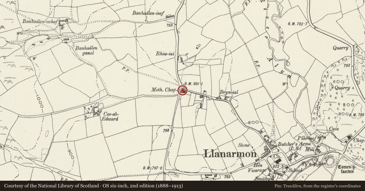
Slide toward Today to fade the historical sheet and see the modern map underneath.
David Rumsey Map Collection, Stanford LibrariesDavid Rumsey Map Collection, Stanford LibrariesDavid Rumsey Map Collection, Stanford LibrariesLlyfrgell Genedlaethol Cymru – The National Library of WalesDavid Rumsey Map Collection, Stanford Libraries
5 historical maps cover this location, the earliest the 1795 map "To Sir Watkin Williams-Wynn Bart ... the map of the six counties of North Wales is most humbly inscribed by his obedient humble servant" (Llyfrgell Genedlaethol Cymru – The National Library of Wales).
Historical maps covering this location
- 1795 · To Sir Watkin Williams-Wynn Bart ... the map of the six counties of North Wales is most… (Llyfrgell Genedlaethol Cymru – The National Library of Wales)
- 1830 · V.3:11-15:XV. Britisches Reich. A. Kon: England. b. Frstenthum Wales: Shire: 37-40 (David Rumsey Map Collection, Stanford Libraries)
- 1883 · Watershed map England, Wales 3. (David Rumsey Map Collection, Stanford Libraries)
- 1898 · 108 Flint (Hills) (David Rumsey Map Collection, Stanford Libraries)
- 1901 · Sheet 9 and 10. (David Rumsey Map Collection, Stanford Libraries)
Cadw's description
Location
Situated attached to W end of Capel Bethel at Rhiw Ial.
History
Later C19 chapel house, built to match Capel Bethel, which was altered or rebuilt in 1867.
Exterior
Chapel house, square rock-faced grey limestone with flush grey ashlar sills and heads. Slate close-eaved roof with one limestone chimney on ridge to left of centre. Two-storey, four-window front of 12-pane hornless sashes with single slab ashlar heads and flush sills. Three such windows to first floor, as second window is a much smaller 2-pane sash with slightly cambered head. Ground floor has 2 such 12-pane sashes in first and third bays, with arched doors to second and fourth bays. Ledged doors, the one to left with plate glass in fan, the one to right with blank tympanum. Cut stone to arches and keystones. Right end wall is random rubble and has 2 x 9-pane horned sashes with timber lintels to first floor. Left end is attached to end wall of chapel.
Reason for designation
Included as part of a good chapel group with Capel Bethel and the Parry monument.
Nearby in the register
- Capel BethelReligious, Ritual and Funeraryunder 1 mi
- Parry MonumentCommemorativeunder 1 mi
- Llwyn OnnDomesticunder 1 mi
- Yale CottageDomesticunder 1 mi
Other entries of the same register within about three miles of this one, by straight line.