Cof Cymru: National Historic Assets of Wales · Wales
Hen Ysgol and Church Hall
Llanidan, Isle of Anglesey, Wales
A Grade II listed building in Brynsiencyn, Llanidan, Isle of Anglesey, designated on 20 May 1998.
The record
- Designation
- Listed building, Grade II
- Broad class
- Religious, Ritual and Funerary
- Date of designation
- 20 May 1998
- Locality
- Brynsiencyn
- Town
- Brynsiencyn
- Community
- Llanidan
- Unitary authority
- Isle of Anglesey
- Country
- Wales
- Coordinates
- 53.18213, -4.26406
- Cadw reference
- 19878
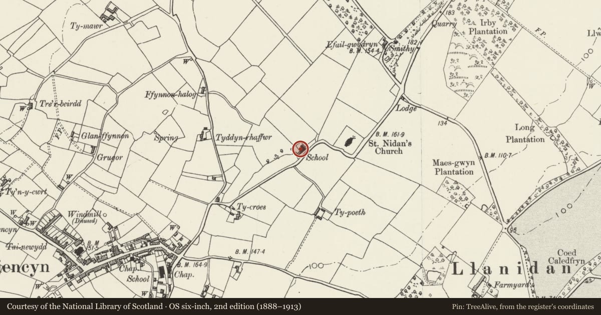
Slide toward Today to fade the historical sheet and see the modern map underneath.
David Rumsey Map Collection, Stanford LibrariesDavid Rumsey Map Collection, Stanford LibrariesDavid Rumsey Map Collection, Stanford LibrariesDavid Rumsey Map Collection, Stanford LibrariesDavid Rumsey Map Collection, Stanford Libraries
5 historical maps cover this location, the earliest the 1883 map "Watershed map England, Wales 3." (David Rumsey Map Collection, Stanford Libraries).
Historical maps covering this location
- 1883 · Watershed map England, Wales 3. (David Rumsey Map Collection, Stanford Libraries)
- 1896 · Sheet 7. Ordnance Survey of England and Wales. (David Rumsey Map Collection, Stanford Libraries)
- 1899 · 105 Carnarvon (Hills) (David Rumsey Map Collection, Stanford Libraries)
- 1901 · Sheet 9 and 10. (David Rumsey Map Collection, Stanford Libraries)
- 1919 · Sheet 41. Anglesey. (David Rumsey Map Collection, Stanford Libraries)
Cadw's description
Location
Located on a side road on the N side of the A4080 Brynsiencyn Road, c150m W of the Church of St. Nidan (New Church).
History
School-master's house with attached school. Built in the mid C19, to serve the new church of St. Nidan (built 1839). The school-master's house is now a dwelling, and the school a church hall.
Exterior
A symmetrically-planned, 3-window range with central entrance, and triple gables over upper windows, the whole offset to the left, to incorporate secondary entrance to the right. Lean-to addition to W, former school to E. Rubble walls with slate roof covering, stone chimney stacks to either gable end. Windows mostly 4 pane horned sash windows with flat stone arch lintels to ground floor. First floor windows extend slightly into gables. Main porch has rubble walls, gabled roof with fish-scale pattern slate covering, and dressed stone ball finial. Round arch to porch doorway. The porch to the right (E) is identical. The lean-to to the left (W) has a single 4 pane horned sash window. The former school abuts the E side of the house; single storeyed with a pitched roof, with a gable to the right (E) end. Roof covering of thin slates, with dressed stone kneelers and coping of thin slabs. Central porch as for the house. To the left (W) of the door is a single large window with 18 panes; to the right (E) is a larger window inset in the gable, with 20 panes. Both windows have flat stone arches. The gable continues to rear to form a three window hall, with small-paned windows.
Reason for designation
Listed as a mid C19 school and school-house group retaining original character, and forming a group with the Church of St. Nidan (new church).
Nearby in the register
- Church of St. Nidan (new church)Religious, Ritual and Funeraryunder 1 mi
- Round Barrow East of BrynsiencynRound Barrowunder 1 mi
- Ty CapelDomesticunder 1 mi
- Capel LibanusReligious, Ritual and Funeraryunder 1 mi
Other entries of the same register within about three miles of this one, by straight line.