Cof Cymru: National Historic Assets of Wales · Wales
Sundial and base at the Church of St Nefydd and St Mary
Llannefydd, Conwy, Wales
A Grade II listed building in Llannefydd, Conwy, designated on 15 May 1998.
The record
- Designation
- Listed building, Grade II
- Broad class
- Religious, Ritual and Funerary
- Date of designation
- 15 May 1998
- Locality
- Llannefydd
- Community
- Llannefydd
- Unitary authority
- Conwy
- Country
- Wales
- Coordinates
- 53.22266, -3.52637
- Cadw reference
- 19851
Slide toward Today to fade the historical sheet and see the modern map underneath.
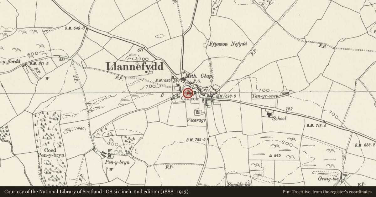
David Rumsey Map Collection, Stanford LibrariesNational Library of ScotlandDavid Rumsey Map Collection, Stanford LibrariesLlyfrgell Genedlaethol Cymru – The National Library of WalesDavid Rumsey Map Collection, Stanford Libraries
5 historical maps cover this location, the earliest the 1795 map "To Sir Watkin Williams-Wynn Bart ... the map of the six counties of North Wales is most humbly inscribed by his obedient humble servant" (Llyfrgell Genedlaethol Cymru – The National Library of Wales).
Historical maps covering this location
- 1795 · To Sir Watkin Williams-Wynn Bart ... the map of the six counties of North Wales is most… (Llyfrgell Genedlaethol Cymru – The National Library of Wales)
- 1830 · V.3:11-15:XV. Britisches Reich. A. Kon: England. b. Frstenthum Wales: Shire: 37-40 (David Rumsey Map Collection, Stanford Libraries)
- 1883 · Watershed map England, Wales 3. (David Rumsey Map Collection, Stanford Libraries)
- 1901 · Sheet 9 and 10. (David Rumsey Map Collection, Stanford Libraries)
- 1963 · Map No. 35 - Local Government Commission for Wales : [Definitive maps showing proposed… (National Library of Scotland)
Cadw's description
Location
Within the churchyard, immediately to the NW of the church.
History
Former Parish Cross, presumably of late medieval date, and originally sited at the village crossroads. The cross was subsequently cut down and converted into a sundial base c1766; the brass sundial is said to have been the gift of Sir Robert Salusbury Cotton of Lleweni. In 1871 the cross base was removed to the vicarage grounds and was finally moved to its present location in 1978.
Exterior
Large stone base with chamfered corners, with a surmounting sandstone cross shaft of approximately 1m height; this is octagonal with stopped chamfers to the bottom. The truncated top of this has a fine brass sundial by Thomas Heath of London; inscribed around the sandstone rim is a churchwardens' dedication (lettering indistinct) with the date 17[66].
Reason for designation
Listed for its special historic interest as a former Parish Cross, later converted for use as a sundial.
Group value with the Church of St Nefydd and St Mary.
Nearby in the register
- Bier-house at the Church of St Nefydd and St MaryReligious, Ritual and Funeraryunder 1 mi
- Church of St Nefydd and St MaryReligious, Ritual and Funeraryunder 1 mi
- Agricultural Range at Bryn DeunyddAgriculture and Subsistenceunder 1 mi
- Bryn DeunyddDomesticunder 1 mi
Other entries of the same register within about three miles of this one, by straight line.