Cof Cymru: National Historic Assets of Wales · Wales
Barn 100m NE of Cae Glas
Llanfrothen, Gwynedd, Wales
A Grade II listed building in Croesor, Llanfrothen, Gwynedd, designated on 14 May 1998.
The record
- Designation
- Listed building, Grade II
- Broad class
- Agriculture and Subsistence
- Date of designation
- 14 May 1998
- Locality
- Croesor
- Community
- Llanfrothen
- Unitary authority
- Gwynedd
- Country
- Wales
- Coordinates
- 52.98244, -4.04498
- Cadw reference
- 19839
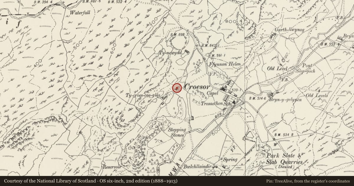
Slide toward Today to fade the historical sheet and see the modern map underneath.
David Rumsey Map Collection, Stanford LibrariesDavid Rumsey Map Collection, Stanford LibrariesDavid Rumsey Map Collection, Stanford LibrariesLlyfrgell Genedlaethol Cymru – The National Library of WalesDavid Rumsey Map Collection, Stanford Libraries
5 historical maps cover this location, the earliest the 1795 map "To Sir Watkin Williams-Wynn Bart ... the map of the six counties of North Wales is most humbly inscribed by his obedient humble servant" (Llyfrgell Genedlaethol Cymru – The National Library of Wales).
Historical maps covering this location
- 1795 · To Sir Watkin Williams-Wynn Bart ... the map of the six counties of North Wales is most… (Llyfrgell Genedlaethol Cymru – The National Library of Wales)
- 1883 · Watershed map England, Wales 3. (David Rumsey Map Collection, Stanford Libraries)
- 1896 · Sheet 7. Ordnance Survey of England and Wales. (David Rumsey Map Collection, Stanford Libraries)
- 1899 · 119 Snowdon (Hills) (David Rumsey Map Collection, Stanford Libraries)
- 1901 · Sheet 9 and 10. (David Rumsey Map Collection, Stanford Libraries)
Cadw's description
Location
Located approximately 100m NE of Cae Glas, set gable into a hill-slope and with a modern barn adjoining to the NE.
History
3-bay boulder-built barn of late C17 or early C18 date and associated with the nearby Cae Glas.
Exterior
Small rectangular field barn of rubble construction on boulder foundations; old slates to SW roof pitch, corrugated iron to NE, unkneelered rubble gable parapets. Recessed boarded door to downhill gable end and loading bay to uphill gable; further entrance to NE side, with recessed boarded door as before.
Interior
3-bay interior with original collar-and-tie-beam roof trusses and pegged purlins, all with rough scantling.
Reason for designation
Listed for its special interest as a complete surviving late C17/early C18 vernacular field barn.
Nearby in the register
- Cae GlasDomesticunder 1 mi
- Barn 25m SE of Cae GlasAgriculture and Subsistenceunder 1 mi
- Unenclosed Hut Circle Settlement East of Garth-y-FoelUnenclosed hut circleunder 1 mi
- Boulder-built Boundary Walls above the Upper Drive at ParcGardens, Parks and Urban Spacesunder 1 mi
Other entries of the same register within about three miles of this one, by straight line.