Cof Cymru: National Historic Assets of Wales · Wales
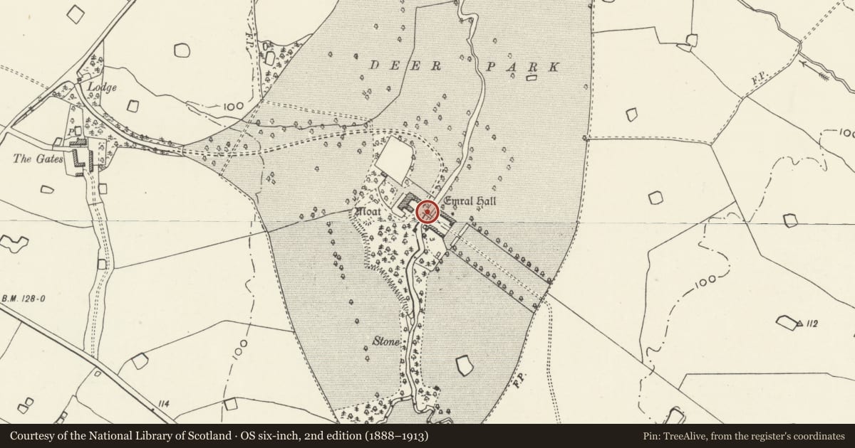
Bridge to West of stable courtyard at Emral Hall
Willington Worthenbury, Wrexham, Wales
A Grade II listed building in Emral, Wrexham, Willington Worthenbury, designated on 7 May 1998.
The record
- Designation
- Listed building, Grade II
- Broad class
- Transport
- Date of designation
- 7 May 1998
- Locality
- Emral
- Town
- Wrexham
- Community
- Willington Worthenbury
- Unitary authority
- Wrexham
- Country
- Wales
- Coordinates
- 52.99165, -2.86519
- Cadw reference
- 19783
Slide toward Today to fade the historical sheet and see the modern map underneath.
David Rumsey Map Collection, Stanford LibrariesDavid Rumsey Map Collection, Stanford LibrariesDavid Rumsey Map Collection, Stanford LibrariesDavid Rumsey Map Collection, Stanford LibrariesDavid Rumsey Map Collection, Stanford Libraries
5 historical maps cover this location, the earliest the 1637 map "Particular description of Wales. Cambria seu Wallia" (David Rumsey Map Collection, Stanford Libraries).
Historical maps covering this location
- 1637 · Particular description of Wales. Cambria seu Wallia (David Rumsey Map Collection, Stanford Libraries)
- 1861 · 73. Market Drayton. (David Rumsey Map Collection, Stanford Libraries)
- 1883 · Watershed map England, Wales 3. (David Rumsey Map Collection, Stanford Libraries)
- 1897 · 122 Nantwich (Hills) (David Rumsey Map Collection, Stanford Libraries)
- 1901 · Sheet 9 and 10. (David Rumsey Map Collection, Stanford Libraries)
Cadw's description
Location
Crosses Emral Brook on the approach to the stable courtyard at the former Emral Hall. Site now accessed from Emral Hall Lodge.
History
Probably contemporary with the former Emral Hall and associated stable ranges which were designed by Richard Trubshaw and Joseph Evans; the house was built between 1724 and 1727 and the stable courtyard between 1730 and 1735. This bridge carried the main drive to the house. The original design included 'pepper-pot' guardrooms to the north and south sides but these have been demolished as has Emral Hall itself in 1936. A cell at the western end of the bridge is said to have been occasionally used as a prison.
Exterior
Single-span semi-circular arched stone bridge surmounted by low parapet walls of brick with stone dressings; these parapet walls continue into the stable courtyard. At the western end is a small cell.
Reason for designation
Included for group value with the North and South Stable Blocks at Emral Hall as part of a designed C18 group associated with the architect Richard Trubshaw.
Nearby in the register
- North Stable Block at Emral HallDomesticunder 1 mi
- South Stable Block at Emral HallDomesticunder 1 mi
- Ice House to rear of North Stable Block at Emral HallDomesticunder 1 mi
- Emral Hall LodgeDomesticunder 1 mi
Other entries of the same register within about three miles of this one, by straight line.