Cof Cymru: National Historic Assets of Wales · Wales
Bridge at Plas Coch
Llanddaniel Fab, Isle of Anglesey, Wales
A Grade II listed building in Plas Coch Estate, Llanddaniel Fab, Isle of Anglesey, designated on 23 April 1998.
The record
- Designation
- Listed building, Grade II
- Broad class
- Transport
- Date of designation
- 23 April 1998
- Locality
- Plas Coch Estate
- Community
- Llanddaniel Fab
- Unitary authority
- Isle of Anglesey
- Country
- Wales
- Coordinates
- 53.19256, -4.22951
- Cadw reference
- 19752
Slide toward Today to fade the historical sheet and see the modern map underneath.
David Rumsey Map Collection, Stanford LibrariesDavid Rumsey Map Collection, Stanford LibrariesDavid Rumsey Map Collection, Stanford LibrariesDavid Rumsey Map Collection, Stanford LibrariesLlyfrgell Genedlaethol Cymru – The National Library of Wales
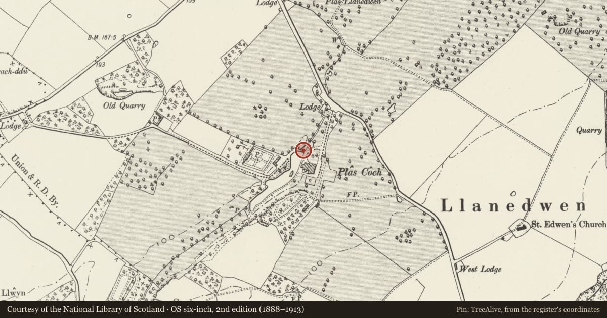
5 historical maps cover this location, the earliest the 1795 map "To Sir Watkin Williams-Wynn Bart ... the map of the six counties of North Wales is most humbly inscribed by his obedient humble servant" (Llyfrgell Genedlaethol Cymru – The National Library of Wales).
Historical maps covering this location
- 1795 · To Sir Watkin Williams-Wynn Bart ... the map of the six counties of North Wales is most… (Llyfrgell Genedlaethol Cymru – The National Library of Wales)
- 1896 · Sheet 7. Ordnance Survey of England and Wales. (David Rumsey Map Collection, Stanford Libraries)
- 1899 · 105 Carnarvon (Hills) (David Rumsey Map Collection, Stanford Libraries)
- 1901 · Sheet 9 and 10. (David Rumsey Map Collection, Stanford Libraries)
- 1919 · Sheet 41. Anglesey. (David Rumsey Map Collection, Stanford Libraries)
Cadw's description
Location
Located to the north of Plas Coch, within the grounds of the house. There is an ornamental pond to its south side.
History
Probably dating from the early C19, when many improvements were made to the Plas Coch estate. The grounds around Plas Coch form part of an ancient estate, first recorded as belonging to Bran (c1150-80) and also known as Porthamel Issa. The original house was built in 1569 by David Hughes, with later remodelling and alterations.
Exterior
Low bridge of 7 spans, rubble built with dressed stone arches, chamfered coping to low parapet and decorative piers; the latter having a raised stepped panel in the mannerist idiom, incorporating a shield in the centre on each facing panel, and stepped cornice.
Reason for designation
Listed as an early C19 estate-built bridge, and for group value with Plas Coch, the decorative walling in front of the house and the lodge, walling and gate piers by the entrance.
Nearby in the register
- Plas CochDomesticunder 1 mi
- Decorative walling in front of Plas CochGardens, Parks and Urban Spacesunder 1 mi
- Plas Coch LodgeDomesticunder 1 mi
- Walls and gatepiers at entrance to Plas CochDomesticunder 1 mi
Other entries of the same register within about three miles of this one, by straight line.