Cof Cymru: National Historic Assets of Wales · Wales
The Old Post Office
Llantysilio, Denbighshire, Wales
A Grade II listed building in Rhewl, Llangollen, Llantysilio, Denbighshire, designated on 22 April 1998.
The record
- Designation
- Listed building, Grade II
- Broad class
- Domestic
- Date of designation
- 22 April 1998
- Locality
- Rhewl
- Town
- Llangollen
- Community
- Llantysilio
- Unitary authority
- Denbighshire
- Country
- Wales
- Coordinates
- 52.99386, -3.22541
- Cadw reference
- 19680
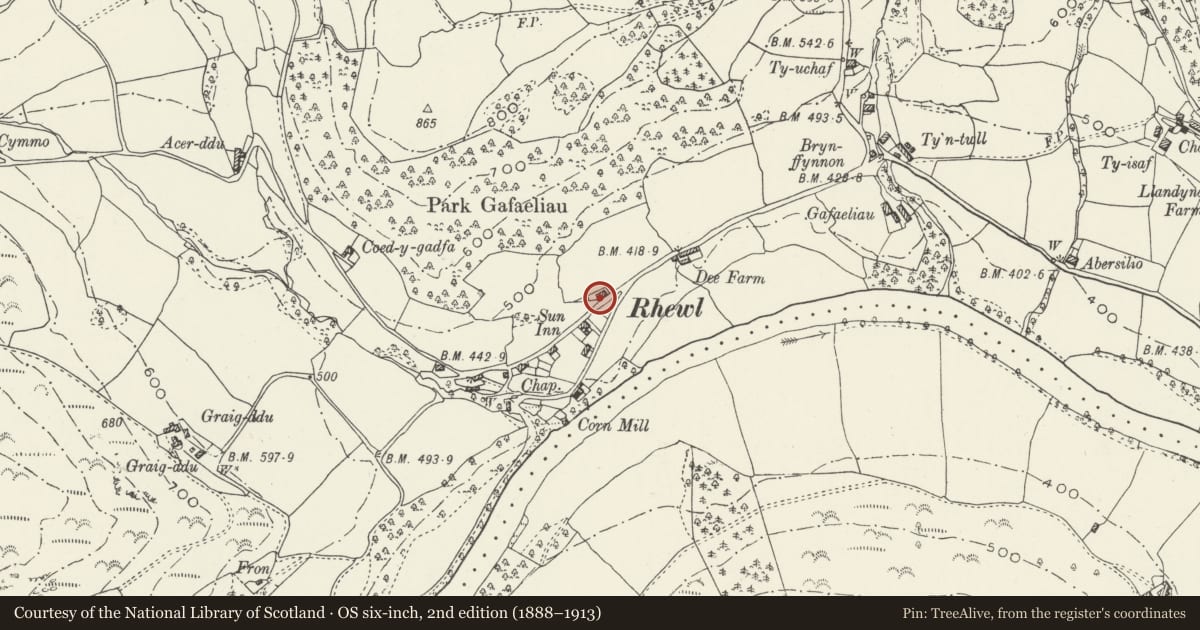
Slide toward Today to fade the historical sheet and see the modern map underneath.
David Rumsey Map Collection, Stanford LibrariesDavid Rumsey Map Collection, Stanford LibrariesDavid Rumsey Map Collection, Stanford LibrariesDavid Rumsey Map Collection, Stanford LibrariesLlyfrgell Genedlaethol Cymru – The National Library of Wales
5 historical maps cover this location, the earliest the 1795 map "To Sir Watkin Williams-Wynn Bart ... the map of the six counties of North Wales is most humbly inscribed by his obedient humble servant" (Llyfrgell Genedlaethol Cymru – The National Library of Wales).
Historical maps covering this location
- 1795 · To Sir Watkin Williams-Wynn Bart ... the map of the six counties of North Wales is most… (Llyfrgell Genedlaethol Cymru – The National Library of Wales)
- 1883 · Watershed map England, Wales 3. (David Rumsey Map Collection, Stanford Libraries)
- 1898 · 121 Wrexham (Hills) (David Rumsey Map Collection, Stanford Libraries)
- 1898 · 121 Wrexham (Outline) (David Rumsey Map Collection, Stanford Libraries)
- 1901 · Sheet 9 and 10. (David Rumsey Map Collection, Stanford Libraries)
Cadw's description
Location
The building is located beside the road, approximately 50m W of the fork on the N branch of the minor road from Rhewl to Carrog. The telephone kiosk stands close in front of its eastern bay.
History
Built in 1813 by E Edwards (date stone on facade), and later served as the village post office for Rhewl.
Exterior
Whitewashed stone with a slate roof. Two storeys, 2 bays, with central through hall. Four-panelled door, and 16-paned sash windows each side on both floors, all provided with painted wedge lintels. The date is set in an oval moulded stone placed above the door. Gable stacks. Lean-to at rear. The lower right hand sash window has been replaced with a fixed light.
Interior
No access at the time of inspection. RCAHMW reports a slate flagged floor, and 6-panelled doors. Plain staircase and studded partitions.
Reason for designation
Included as a well preserved example of an early C19 vernacular house.
Nearby in the register
- Telephone Call-boxCommunicationsunder 1 mi
- The Sun InnCommercialunder 1 mi
- Ty-isaDomesticunder 1 mi
- Barn at Pendre FarmAgriculture and Subsistenceunder 1 mi
Other entries of the same register within about three miles of this one, by straight line.