Cof Cymru: National Historic Assets of Wales · Wales
Central Salmon Well
Penllyn, Vale of Glamorgan, Wales
A Grade II listed building in Penllyn, Cowbridge, Vale of Glamorgan, designated on 9 April 1998.
The record
- Designation
- Listed building, Grade II
- Broad class
- Water Supply and Drainage
- Date of designation
- 9 April 1998
- Locality
- Penllyn
- Town
- Cowbridge
- Community
- Penllyn
- Unitary authority
- Vale of Glamorgan
- Country
- Wales
- Coordinates
- 51.47980, -3.48116
- Cadw reference
- 19654
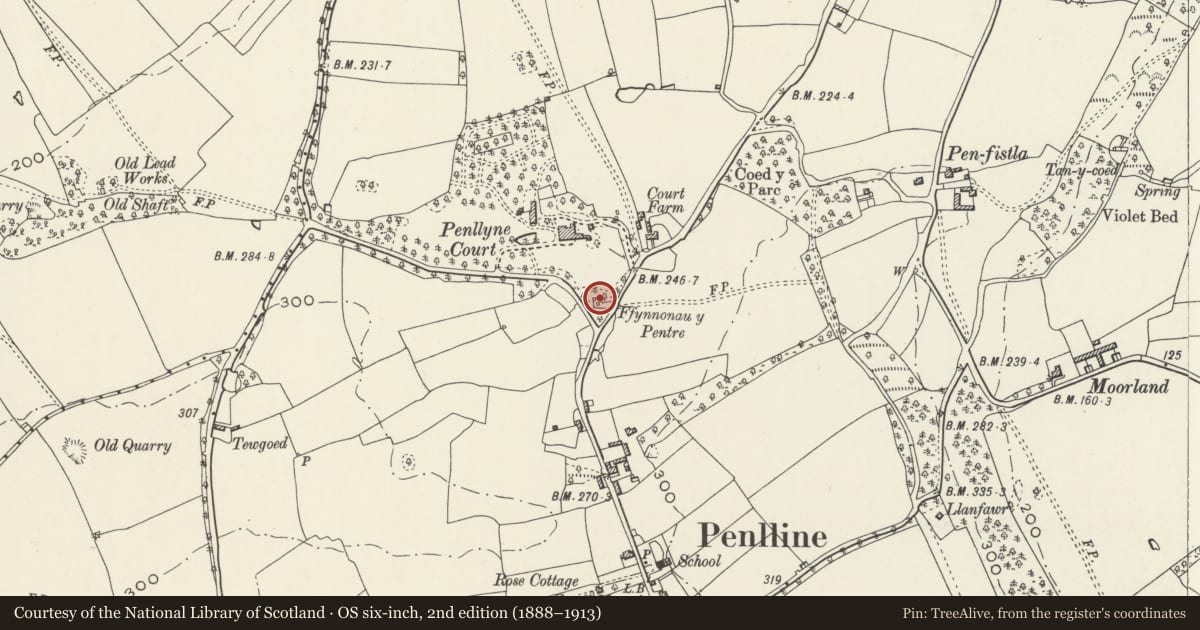
Slide toward Today to fade the historical sheet and see the modern map underneath.
David Rumsey Map Collection, Stanford LibrariesDavid Rumsey Map Collection, Stanford LibrariesDavid Rumsey Map Collection, Stanford LibrariesDavid Rumsey Map Collection, Stanford LibrariesDavid Rumsey Map Collection, Stanford Libraries
5 historical maps cover this location, the earliest the 1636 map "Cornubia : Devonia, Somersetus, Dorcestria, Wiltonia, Glocestria ..." (David Rumsey Map Collection, Stanford Libraries).
Historical maps covering this location
- 1636 · Cornubia : Devonia, Somersetus, Dorcestria, Wiltonia, Glocestria ... (David Rumsey Map Collection, Stanford Libraries)
- 1637 · The fourth table of England. Cornub. Devonia, Somerset etc. (David Rumsey Map Collection, Stanford Libraries)
- 1865 · England and Wales. England No. 6. (David Rumsey Map Collection, Stanford Libraries)
- 1897 · 262 Pontypridd (Hills) (David Rumsey Map Collection, Stanford Libraries)
- 1897 · 262 Pontypridd (Outline) (David Rumsey Map Collection, Stanford Libraries)
Cadw's description
Location
Central well of a group of three to north of village of Penllyn, near road junction to south of Penllyn Court.
History
One of a group of three wells supplying water to the village. In 1883 Dr William Salmon, concerned for the public health of the area, donated community wells to serve the villages of Penllyn and Graig Penllyn, but the springs were probably used, before being enclosed, back to medieval times. Restored and landscaped in 2000 as part of a Community Millennium project.
Exterior
Rectangular well covered by rubble hut circa 2m high, set into rising bank to rear. Flight of stone steps to left is part of the Millenium repairs. Outflow into stone walled channel.
Reason for designation
Included for its special interest as part of a possibly unique group of three wells serving villages of Penllyn and Graig Penllyn.
Nearby in the register
- Westernmost Salmon WellWater Supply and Drainageunder 1 mi
- Easternmost Salmon WellWater Supply and Drainageunder 1 mi
- Village FarmhouseDomesticunder 1 mi
- The Old School HouseEducationunder 1 mi
Other entries of the same register within about three miles of this one, by straight line.