Cof Cymru: National Historic Assets of Wales · Wales
Barn and Stable Range W of Saethon
Llanengan, Gwynedd, Wales
A Grade II listed building in Saethon, Pwllheli, Llanengan, Gwynedd, designated on 1 April 1998.
The record
- Designation
- Listed building, Grade II
- Broad class
- Agriculture and Subsistence
- Date of designation
- 1 April 1998
- Locality
- Saethon
- Town
- Pwllheli
- Community
- Llanengan
- Unitary authority
- Gwynedd
- Country
- Wales
- Coordinates
- 52.86516, -4.53596
- Cadw reference
- 19643
Slide toward Today to fade the historical sheet and see the modern map underneath.
David Rumsey Map Collection, Stanford LibrariesDavid Rumsey Map Collection, Stanford LibrariesDavid Rumsey Map Collection, Stanford LibrariesDavid Rumsey Map Collection, Stanford LibrariesDavid Rumsey Map Collection, Stanford Libraries
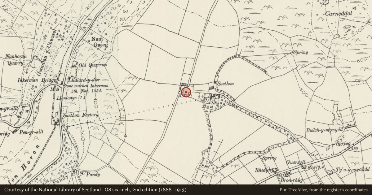
5 historical maps cover this location, the earliest the 1608 map "(13) Cambriae Typus." (David Rumsey Map Collection, Stanford Libraries).
Historical maps covering this location
- 1608 · (13) Cambriae Typus. (David Rumsey Map Collection, Stanford Libraries)
- 1830 · V.3:11-15:XV. Britisches Reich. A. Kon: England. b. Frstenthum Wales: Shire: 37-40 (David Rumsey Map Collection, Stanford Libraries)
- 1883 · Watershed map England, Wales 3. (David Rumsey Map Collection, Stanford Libraries)
- 1899 · 134 Pwllheli (Hills) (David Rumsey Map Collection, Stanford Libraries)
- 1901 · Sheet 9 and 10. (David Rumsey Map Collection, Stanford Libraries)
Cadw's description
Location
Situated some 150m W of Saethon.
History
Barn, probably C18, with added mid C19 range of cow-houses to the right. RCAHM suggests a much earlier date for the barn, 'a little later than the houses', ie late C16 or C17.
Exterior
Barn, rubble stone with slate roof of grouted small slates, and attached lower range to right. Barn has low door to left of centre with slab lintel. One loop to left, 2 to right. Massive boulder footings and large blocks in wall. Rear has double doors with slab lintel and loft window left. One loop right. W end loft door. Lower range has purple slates, doors to left of centre and right. Slab lintels. Rear has 2 projecting gabled wings with small end windows and lean-to between, with door.
Interior
Barn has 5 pegged collar trusses, 2 missing collars, and triple purlins. Adjoining range has 4 C19 wishbone trusses and triple purlins.
Reason for designation
A substantial estate barn, of a type relatively rare in the region, and part of an historic group with the other buildings further E at Saethon.
Nearby in the register
- Saethon Old FarmhouseDomesticunder 1 mi
- Outbuilding to E of SaethonDomesticunder 1 mi
- Outbuilding to N of SaethonAgriculture and Subsistenceunder 1 mi
- RhedynDomesticunder 1 mi
Other entries of the same register within about three miles of this one, by straight line.