Cof Cymru: National Historic Assets of Wales · Wales
Pont yr Henblas
Llangwm, Conwy, Wales
A Grade II listed building in Llangwm, Conwy, designated on 1 April 1998.
The record
- Designation
- Listed building, Grade II
- Broad class
- Transport
- Date of designation
- 1 April 1998
- Locality
- Llangwm
- Community
- Llangwm
- Unitary authority
- Conwy
- Country
- Wales
- Coordinates
- 52.98696, -3.56936
- Cadw reference
- 19585
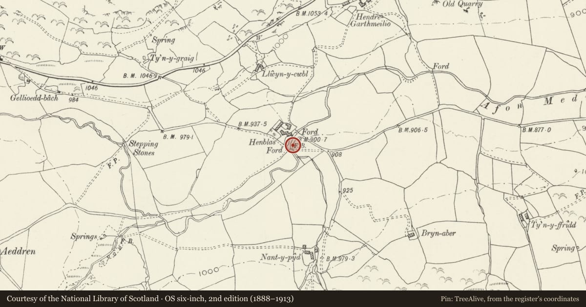
Slide toward Today to fade the historical sheet and see the modern map underneath.
David Rumsey Map Collection, Stanford LibrariesDavid Rumsey Map Collection, Stanford LibrariesLlyfrgell Genedlaethol Cymru – The National Library of WalesDavid Rumsey Map Collection, Stanford LibrariesDavid Rumsey Map Collection, Stanford Libraries
5 historical maps cover this location, the earliest the 1795 map "To Sir Watkin Williams-Wynn Bart ... the map of the six counties of North Wales is most humbly inscribed by his obedient humble servant" (Llyfrgell Genedlaethol Cymru – The National Library of Wales).
Historical maps covering this location
- 1795 · To Sir Watkin Williams-Wynn Bart ... the map of the six counties of North Wales is most… (Llyfrgell Genedlaethol Cymru – The National Library of Wales)
- 1830 · V.3:11-15:XV. Britisches Reich. A. Kon: England. b. Frstenthum Wales: Shire: 37-40 (David Rumsey Map Collection, Stanford Libraries)
- 1883 · Watershed map England, Wales 3. (David Rumsey Map Collection, Stanford Libraries)
- 1898 · 120 Corwen (Hills) (David Rumsey Map Collection, Stanford Libraries)
- 1901 · Sheet 9 and 10. (David Rumsey Map Collection, Stanford Libraries)
Cadw's description
Location
The bridge is near Henblas farm, on the minor road running W from the village.
History
Probably built in the early-mid C18, surviving from before the major improvements to country bridges which commenced in the last decades of the century.
Exterior
Built of local rubble stone. Three close-spaced rectangular openings passing diagonally under the road, each opening approximately 1.2m wide and 1.5m from water level to the slate capping slabs, each water pier protected on the upstream side by a selected boulder cutwater. The flush spandrels extend up into low flush stone-coped parapets, the N parapet curved at the W end.
Reason for designation
Included as a good example of the medieval type of bridge that was probably widespread before the late C18 improvements, thus one of the earliest surviving bridges of the area.
Nearby in the register
- GarthmeilioDomesticunder 1 mi
- Church of St JeromeReligious, Ritual and Funerary1 mi
- Four Chest Tombs at the Church of St JeromeReligious, Ritual and Funerary1 mi
- Pont-y-capelTransport1 mi
Other entries of the same register within about three miles of this one, by straight line.